

March 04, 2026
- Urban occupation in high-slope areas, more susceptible to landslides, has tripled in four decades
- Urbanization near drainages, with higher flood risk, grew by 145%
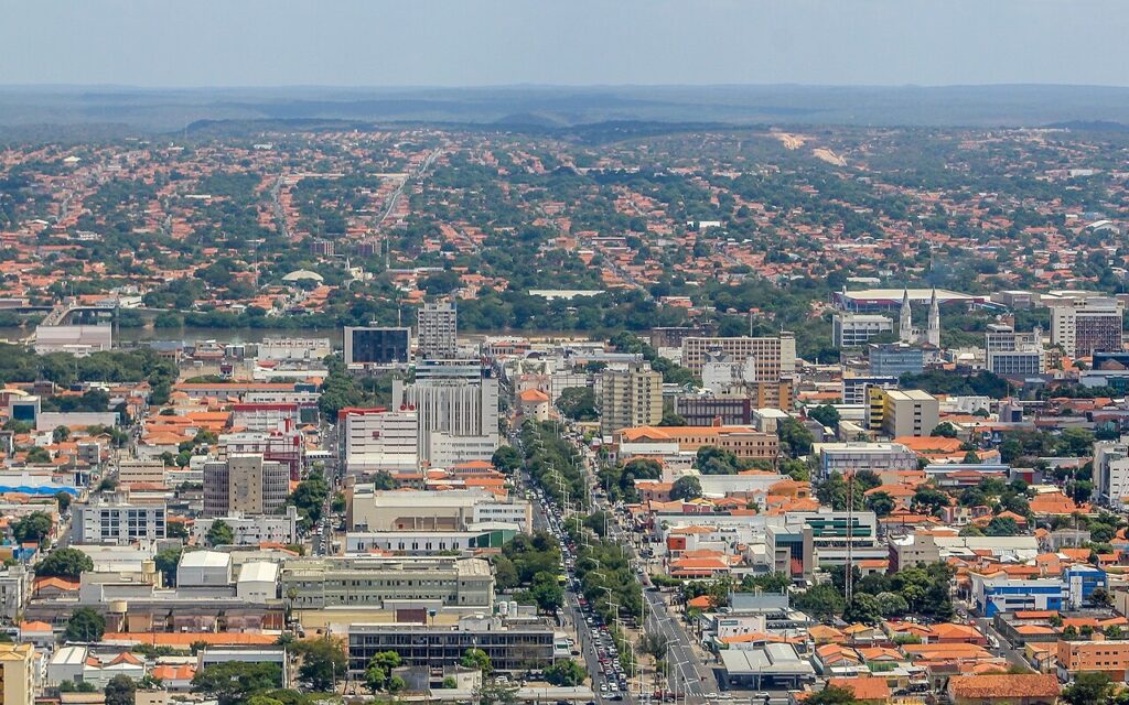
Brazil's rapid and recent urbanization has occupied several areas that may be subject to risks—either due to steep slopes, which favor erosion and landslides, or due to proximity to drainage areas (waterways and drainage channels or rivers, streams, and drainage channels), where the probability of flooding is higher. This is shown by the latest updated data on the annual mapping of urbanized areas in Brazil between 1985 and 2024, which MapBiomas launches this Wednesday, March 4.
In the last four decades, urban areas in Brazil grew 2.5 times, from 1.8 million hectares in 1985 to 4.5 million hectares in 2024, or 0.5% of the national territory—an average increase of about 70,000 hectares per year. Meanwhile, urbanized areas on steep slopes increased more than 3 times in the same period. In 1985, there were 14,000 hectares; in 2024, 43,400. Of this total, 40,500 hectares are in urban areas of the Atlantic Forest.
“Urban expansion must be considered in the context of risk and climate change, which affects everyone, but have a particularly dramatic impact on more sensitive and vulnerable areas, whose occupation has happened faster than the overall rate of urbanization,” highlights Mayumi Hirye, one of the coordinators of the MapBiomas urban area mapping.
State of Minas Gerais leads in urbanized area on steep slopes
Minas Gerais is the state with the largest urbanized area on steep slopes in Brazil. Between 1985 and 2024, this area tripled, reaching nearly 14,500 hectares. Juiz de Fora, in turn, is the third city with the largest urbanization area on terrain with a slope above 30% in the country, behind only the cities of Rio de Janeiro and São Paulo. Between 1985 and 2024, this occupation increased 2.3 times: from 547 hectares to 1,256 hectares in 2024.
“The urbanization process of the state of Minas Gerais, the second state with the largest urbanized area in Brazil, permanently challenges geography. The advance of urbanization over steep terrain is a very strong pattern in the Zona da Mata, where Juiz de Fora is located,” informs Talita Micheleti, from the MapBiomas urbanized area mapping team. “The data shows that Juiz de Fora reflects this problem in an extreme way; although it is a medium-sized city, it is already the third city in the country with the largest urban occupation in hillside areas and potential risk,” she adds.
Rio Grande do Sul and Santa Catarina were the states with the highest growth in steep-slope urbanization in proportional terms. The increase was 7 times in the state of Rio Grande do Sul and 6 times in the state of Santa Catarina. The state of Rio de Janeiro and the state of São Paulo also saw significant growth, reaching 8,600 and 8,100 hectares, respectively, in 2024.
In 1985, the municipalities with the most urbanized areas in high-slope regions were Rio de Janeiro (1,160 hectares), Belo Horizonte (900 hectares), and São Paulo (730 hectares). In 2024, Rio de Janeiro continues to lead (1,700 hectares), but São Paulo has taken second place (1,500 hectares), and Juiz de Fora has moved up to third place (1,300 hectares), ahead of Belo Horizonte (1,200 hectares).
Urbanized areas near drainages increase 145% in four decades
Another indicator of exposure to environmental risk is the vertical difference between the urbanized land surface and the nearest natural drainage, such as a watercourse (a river or a stream, for example). MapBiomas analyzed areas with a difference of up to three meters, which may indicate areas more vulnerable to floods and inundations, and found that they increased 145% in the last 40 years, from 493,000 hectares in 1985 to 1.2 million hectares in 2024.
The cities of Rio de Janeiro and São Paulo hold the first and second places in the ranking of municipalities with the largest urbanized area within three meters of the nearest drainages, both in 1985 (18,180 hectares and 17,030 hectares, respectively) and in 2024 (25,620 hectares and 19,110 hectares). In 1985, Curitiba held third place with 6,200 hectares; in 2024, this position was occupied by Brasília with 16,380 hectares.
When analyzing the area up to 3 meters in height from the nearest drainage area compared to the state's territory, the state of Roraima leads, where 46.4% of the urbanized area is in a situation of vulnerability to floods. In second place is the state of Rio de Janeiro with 43%, followed by the state of Amapá with 37.6%.
“Historically, cities established themselves near bodies of water. Given the increase in the number of extreme events and the set of functions fulfilled by floodplains, it is important to monitor the expansion of urbanized areas on riverbanks, in order to preserve the environment and the population’s quality of life,” points out Edimilson Rodrigues, from the MapBiomas urbanized area mapping team.
Favelas in risk areas: 150% growth on steep slopes and 200% near drainage
MapBiomas also calculated the area of favelas located on steep-slope terrain. There were 2,266 hectares in 1985 and 5,704 hectares in 2024—an increase of more than 150% (3,438 hectares). The state of Rio de Janeiro leads with 1,730 hectares, followed by the state of São Paulo (1,061) and the state of Minas Gerais (1,057).
The area of favelas within 3 meters of vertical distance from drainage areas also grew. The increase was more than 200% between 1985 and 2024 (+30,160 hectares). In 1985, there were 15,847 hectares; in 2024, 45,000 hectares. Pará (7,450 hectares), Rio de Janeiro (5,260 hectares), and São Paulo (4,650 hectares) lead the ranking of states with the largest areas in this condition.
The state of Rio de Janeiro stands out for having one of the country's highest proportions of urbanized areas at critical elevations—43% up to three meters—and, at the same time, one of the largest absolute values of urbanized area in this altimetric range, with about 1.1 million hectares of urbanization near drainage areas in 2024.
“The case of the state of Rio de Janeiro is a magnifying glass on the Brazilian pattern: the data indicates that the expansion of favelas occurred significantly in topographically and hydrologically sensitive areas, with proportionally high growth on both hillsides and at elevations very close to drainages,” emphasizes Julio Pedrassoli, one of the coordinators of the MapBiomas Urbanized Areas mapping.
Favelas grow 2.75 times between 1985 and 2024, above the national urbanization average
Between 1985 and 2024, favela areas grew more than 2.75 times—faster than the expansion rate of urbanized areas (2.5 times) in Brazil. There were 53,700 hectares of urbanized area in favelas in Brazil in 1985; in 2024, 146,000 hectares. The data shows the annual growth of urbanized area within the perimeters of favelas and urban communities, according to the official IBGE delimitation.
Manaus leads the ranking of urbanized areas in favelas in both 1985 and 2024, with a growth of 2.6 times in the period. It is one of the capitals of the North region which, together with those of the Northeast, occupy the top of the ranking of the 10 largest urbanized areas in favelas in Brazil: 7 in 1985 and 8 in 2024, with the entry of Teresina (10th position). Rio de Janeiro, which held second place in 1985 with 3,600 hectares, dropped to fifth place in 2024 with 5,300 hectares. Despite this, the increase in this municipality was nearly 1.5 times. São Paulo, in turn, rose from fourth position (3,100 hectares) to third (6,000 hectares)—a 1.9-fold increase.
The data shows that favelas are a typically metropolitan phenomenon. In 2024, Metropolitan Regions were home to 82% of all urbanized area in favelas in Brazil. In 1985, this concentration was even more significant: only 13% were outside metropolitan regions.
“The faster growth of favela areas compared to the national average and their strong concentration in metropolitan regions suggest a known and worrying trend, where metropolises concentrate much wealth but also intensify structural problems, and in the face of ongoing climate change, a warning signal is lit,” warns Julio Pedrassoli.
São Paulo Metropolitan Region leads in favela area; Brasília concentrates the four fastest-growing ones
In 2024, the metropolitan region of São Paulo has the largest urbanized area in favelas: 11,800 hectares. The metropolitan regions of Manaus (state of Amazonas) and Belém (state of Pará) have slightly smaller areas (11,400 hectares and 11,300 hectares, respectively), but these represent more than a third of the entire urbanized area of those municipalities.
Brasília, meanwhile, stands out for housing the favelas that grew the most in the last 40 years. Of the five favelas that expanded their occupation area the most between 1985 and 2024, four are in the federal capital. If these four favelas in the Federal District were a municipality, their urban area expanded in the last four decades would be greater than the growth of 95% of all urbanized areas in Brazil. Two of them—Sol Nascente and 26 de Setembro—occupy the first and second places of the largest favelas in Brazil, with 599 hectares and 577 hectares, respectively. The Jardim Progresso favela in Natal (state of Rio Grande do Norte)—the third largest in area expansion in Brazil between 1985 and 2024—is the leader in expansion over areas considered to have Minimum and Low Water Security by the National Water Agency (ANA).
“The concentration of the most recent major expansions in the Federal District, combined with their overlap with areas classified as having lower water security, points to a dynamic of accelerated territorial growth within more environmentally restrictive contexts. This represents a risk not only for the populations occupying these areas due to a lack of other suitable options but also for the city's population as a whole,” highlights Julio Pedrassoli.
25% of Brazilian urban expansion occurred in critical water security areas
Of all Brazilian urban expansion over natural areas (670,000 hectares), 25% occurred in critical water security areas (lowest minimum), affecting 1,325 municipalities. In five Brazilian states, more than 70% of urbanization growth between 1985 and 2024 occurred in critical water security areas: Alagoas, Ceará, Paraíba, Rio Grande do Norte, and Sergipe. The municipality of Rio de Janeiro showed the largest absolute growth of urbanization in minimum water security conditions: 7,600 hectares between 1985 and 2024, equivalent to 11,000 soccer fields.
“There is a mismatch between the growth of cities and the availability of water. The fact that 1,325 municipalities expanded their urban footprint under these conditions reveals that the problem is structural and national. It is not just a matter of risk. The scarcity of water for human consumption is already a reality at many times of the year in large Brazilian metropolises, such as the city of São Paulo,” reminds Julio Pedrassoli.
Brazil: 60% of urban growth occurred in the last 40 years
Urbanized areas are characterized by the predominance of buildings (residential, commercial, industrial) and infrastructure (paved streets, sidewalks, service networks). They had an average increase of about 70,000 hectares per year between 1985 and 2024. More than half (60%) of the urbanized area growth in Brazil (2.75 million hectares) occurred after 1985.
More than 680,000 hectares urbanized in 2024 were natural areas in 1985; another 1.84 million hectares were already anthropized, under agricultural use. Urban growth over agricultural land was 2.7 times greater than urban growth over natural area
With the exception of the state of Rio de Janeiro, all states doubled their urbanized area; São Paulo had the largest absolute increase
All Brazilian states, except for Rio de Janeiro, more than doubled their urbanized area in the last four decades. During this period, the states of Alagoas, Tocantins, Goiás, Mato Grosso, Sergipe, Rio Grande do Norte, and Paraíba tripled their urbanized area. São Paulo, meanwhile, was the state with the largest increase in urbanized area: 470,000 hectares—an area similar to the urban growth observed in the entire Caatinga biome.
In 1985, the municipalities with the largest urbanized area were São Paulo (77,600 hectares), Rio de Janeiro (44,000 hectares), and Belo Horizonte (24,100 hectares). In 2024, São Paulo maintained the leadership (90,500 hectares), but Brasília jumped from fifth place in 1985 (21,100 hectares) to second place (62,700 hectares) in the ranking, followed by Rio de Janeiro (59,700 hectares).
Half of Brazilian urbanized areas are in metropolitan regions
In 2024, nearly half (49.7%) of the country's urbanized area (2.3 million hectares) is located in one of the 84 metropolitan regions currently established in the country. Considering all metropolitan regions, a smaller growth is noted compared to other Brazilian municipalities: 127% vs. 184%. The metropolitan region with the highest percentage growth in the last four decades is Palmas, in the state of Tocantins: 414%. In second place is the Integrated Development Region of the Federal District and Surrounding Areas, with 291%. Following these are the metropolitan regions of Goiânia and Sorocaba, in the interior of the state of São Paulo, with growth in the period of 207% and 203%, respectively.
In 1985, more than half (55.2%) of the Brazilian urbanized area (approximately one million hectares) was concentrated in nine metropolitan regions established that year: Belém, Fortaleza, Recife, Salvador, Belo Horizonte, Rio de Janeiro, São Paulo, Curitiba, and Porto Alegre.
Atlantic Forest recorded urban expansion of 1.3 million hectares between 1985 and 2024
The Atlantic Forest is the most urbanized Brazilian biome. Between 1985 and 2024, the urbanized area increased by 1.3 million hectares, which represents 133% of the area in 1985. On average, the increase was 34,200 hectares per year. Urbanization growth in the Atlantic Forest follows the historical process of occupation of the Brazilian territory.
Urban growth doubles population growth rate
The urban expansion that occurred in the four decades between 1985 and 2024 does not reflect the demographic growth recorded in the period. In the last 40 years, the growth of urbanized areas in Brazil (2.4% per year) was more than double the population growth (1.1% per year). A trend of sprawling urban growth with low population density predominates in the country.
“Considering the Brazilian trend of population transition from rural to urban areas, which began in the second half of the 20th century, the way cities expand to accommodate this process is crucial—both for the quality of urban space and for minimizing the conversion of natural areas into urbanized ones,” explains Talita Micheleti, from MapBiomas' urbanized area mapping team.
Vegetated urban areas increase 293%, but vegetation decreases in consolidated regions
Vegetated urbanized areas are patches of vegetation in parks, squares, public and private areas, larger than 4,500 m² and detected in at least five consecutive years. Such areas increased 293% between 1985 and 2024, from 185,000 hectares in 1985 to 620,000 hectares in 2024—the year in which Brasília (with 13,260 hectares), Rio de Janeiro (with 8,180 hectares), and São Paulo (5,920 hectares) topped the ranking of the most vegetated cities in the country. This expansion, however, holds differences between expanding areas and those already consolidated. Urban vegetation increased in city expansion areas and decreased in consolidated areas. Considering only the urbanized area consolidated in 1985, the vegetated area decreased from 158,000 hectares to 145,000 hectares in 2024.
“On one hand, this data validates the perception that we have fewer vegetated areas in cities. On the other, it also reveals a potential, represented by the incorporation of peri-urban areas into cities. These areas are still in the process of occupation, which can incorporate new urban designs and a differentiated relationship between city and nature,” argues Mayumi.
More than half of Brazilian municipalities lost vegetation in consolidated areas. Campo Grande (state of Mato Grosso do Sul), Curitiba (state of Paraná), and Belo Horizonte (state of Minas Gerais) lead the ranking of cities that lost the most vegetated urban areas in consolidated territories. The cities in the South region of Brazil have the lowest average growth: 412 hectares of new urbanized areas with 53 hectares of vegetation, on average. The expansion of cities in this period incorporated 475,000 hectares of vegetation, surpassing the loss of 13,000 hectares in areas consolidated in 1985 and resulting in a positive balance of 462,000 hectares. Brasília, Rio de Janeiro, and São João (state of Pernambuco) were the cities that gained the most vegetated urban areas in the last four decades.
More than 680,000 hectares urbanized in 2024 were natural areas in 1985; another 1.84 million hectares were already anthropized, under agricultural use. Urban growth over agricultural land was 2.7 times greater than urban growth over natural area