

MapBiomas’ new platform provides the most comprehensive survey of evidence of irregularities in the country’s mining activities, with data spanning from 1934 to 2025
December 3, 2025
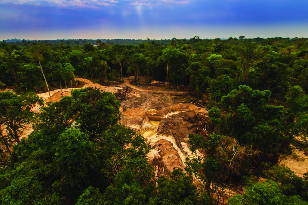
A new platform developed by the MapBiomas Mining team reveals an unprecedented overview of mining activity in Brazil. The data, which consolidates procedural information from the National Mining Agency (ANM) from 1934 to 2025, shows that 91.2% (234,923) of mining processes do not show signs of procedural inconsistency. Out of a total of 257,591 mining processes in Brazil, 22,668 processes (8.8%) present “Signs of Procedural Inconsistency.” There are signs of mining in an inappropriate phase in 11,394 processes (4.4%). Another 10,620 processes (4.1%) fall within Areas Restricted to mining activity, such as Indigenous Lands, Strict Protection Conservation Units, Extractive Reserves (RESEX), and Private Natural Heritage Reserves (RPPN). There are also 654 mining processes (0.3%) that incur both conditions. The MapBiomas Mining Monitor can be accessed for free at www.mapbiomas.org
The platform also allows for the evaluation of CFEM (Financial Compensation for the Exploration of Mineral Resources) collection, considering all mining processes that are required to pay the tax—Mining Concessions, Small scale (Garimpeiro) Mining Permits, Licensing, and Research Authorizations (in the latter case, only when accompanied by a valid Utilization Guide). Based on data from the last six months, 20,632 mining processes (43.6%) recorded CFEM payments during the period, while 26,622 processes (56.4%) did not make the tax payment within the analyzed window.
Pará is the state with the highest number of mining processes with some procedural inconsistency: 31.4% (7,552). Also noteworthy, though with smaller proportions of inconsistency, are the state of Mato Grosso and the state of Minas Gerais, with 13.8% (1,807) and 7.4% (3.937) of processes showing signs of procedural inconsistency, respectively.
“The Mining Monitor was developed to integrate, in a clear and objective manner, data relevant to analyzing the level of compliance of mining activities with the parameters established by national legislation,” explains César Diniz from Solved, who coordinates the MapBiomas Mining team. “Its purpose is to support government agencies in increasing transparency and improving processes related to the production, marketing, and procurement of products derived from mining activities,” he adds.
In a single location, users can perform cross-referencing based on data publicly available from the Ministry of Environment and Climate Change (MMA), the Brazilian Institute of Geography and Statistics (IBGE), the National Foundation for Indigenous Peoples (FUNAI), the Brazilian Institute of Environment and Renewable Natural Resources (IBAMA), the National Mining Agency (ANM), the Mining Geographic Information System (SIGMINE), and MapBiomas. The platform enables the visualization of high-level figures from the database according to the applied filters, offering the following statistics:
- Number of mining processes.
- Distribution of mining processes by phase.
- Distribution of mining processes by signs of procedural inconsistency.
- Mining processes with or without temporal inconsistency.
- Mining processes with or without mining overflow.
- Collection of CFEM (Financial Compensation for the Exploration of Mineral Resources).
- Distribution of mining processes by state.
Users can apply various filters to refine the analysis, including:
- Territorial breakdown: biome, state, municipality, Conservation Unit, and Indigenous Land.
- Stages of Mining Processes:: 15 administrative phases at the ANM.
- Signs of Procedural Inconsistency: separated into categories such as “Mining Process in Restricted Area,” “Sign of Mining in Inappropriate Phase,” and “No Procedural Inconsistency.”
- Temporal inconsistency: processes that show signs of mineral extraction prior to the effective period of a recovery regime.
- Mining boundary overrun: processes that show signs of mineral extraction beyond their limits.
- CFEM Collection: collection of the Financial Compensation for the Exploration of Mineral Resources in the last 6 months.
- Substance: the mineral substance explored.
- Process Year: the year the process was opened/filed.
- Holder Name or NUP (Unique Process Number).
For each Mining Process, the platform generates a detailed report consisting of eight elements, including:
- Process information: number, area (ha), detection, substance, municipality/state, phase, and total CFEM paid.
- Cross-referencing summary: synthesis of process observations, indicating if there is temporal inconsistency, mining boundary overrun, restricted area, permit in inappropriate phase, utilization guide, embargoed area, sign of procedural inconsistency, ghost mining, and CFEM collection.
- Before and after images: LANDSAT images with 30-meter resolution from different years between 1985 and 2025.
- Mining area history: Collection 10 of the MapBiomas annual land cover and use maps in Brazil.
- Annual mosaics – SENTINEL 2: Sentinel mosaics with 10-meter resolution from the last 6 years.
- Mining dynamics within the polygon: records of changes detected within the process polygon area.
- Data sources used in cross-referencing: origin of the data used for the composition of the report.