

Forest areas have remained stable over the last decade; efforts to recover altered areas have not surpassed deforestation in the biome in recent years
October 28, 2025
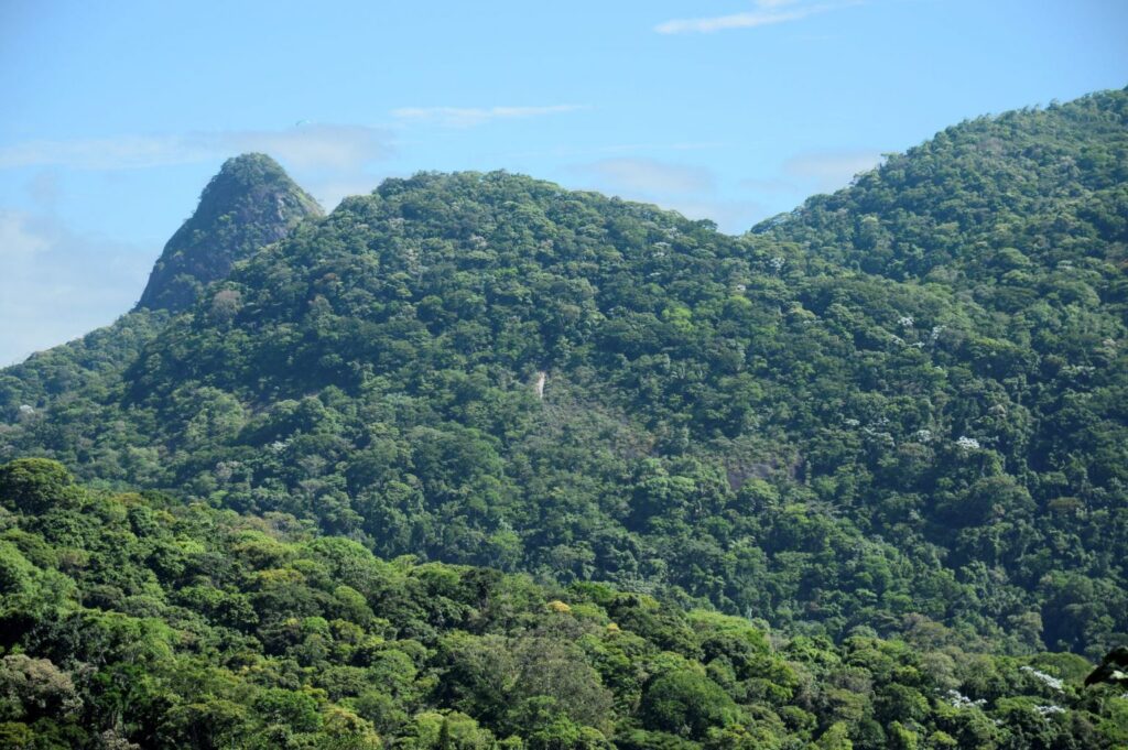
As the biome with the lowest natural vegetation cover in the country, the Atlantic Forest reaches the present day with less than one-third (31%) of its natural cover remaining. Among the 67% of the area occupied by some form of anthropic use, agriculture stands out as the land-use class that grew the most, nearly doubling in area between 1985 and 2024. This is revealed by the latest Atlantic Forest data from MapBiomas’ Collection 10 of land cover and land use maps, launched today (10/28), which tracks the biome's transformations over the past four decades.
"The natural vegetation of the Atlantic Forest has been suppressed to make room for human activities since the beginning of colonization. In 1985, the starting year of our historical series, the biome had only 27% of its original forest area," explains Natalia Crusco from the MapBiomas Atlantic Forest team. "Since then, the pace of deforestation has varied across each of the four decades leading up to 2024. Following the enactment of the Atlantic Forest Law, it is even possible to notice a slight increase in the biome's forested area."
The decade of greatest forest loss occurred between 1985 and 1994, when 4.7 million hectares of forest were converted to farming and ranching—a 7% reduction. Between 1995 and 2004, the deforested area fell by 40% compared to the previous decade, to 2.9 million hectares. Between 2005 and 2014, the effects of the Atlantic Forest Law became evident; during this period, the recovery area was larger than the forest conversion area, resulting in a net gain of 200,000 hectares. Between 2015 and 2024, the scenario again demanded attention: deforestation and recovery areas became equivalent, even after the approval of the Forest Code in 2012, which had the potential to drive a resurgence in regeneration.
Over these 40 years, the loss of forest area totaled 2.4 million hectares, an 8.1% reduction compared to the forest area mapped in 1985. Not only has there been a recorded drop in the pace of deforestation since 1985, but the last five years have still averaged 190,000 hectares of deforested forest per year. About 50% of the deforestation recorded in 2024 still occurs in mature forests (forests over 40 years old), which hold the bulk of biodiversity and carbon stocks and are primarily responsible for the ecosystem services provided by the forest.
Grassland formations (formação campestre), meanwhile, saw a 28% reduction compared to 1985, with annual losses every year since 2000. Conversion accelerated in the last decade, with an average of 38,000 hectares lost per year. Over the last 24 years, approximately 15% of primary vegetation deforestation in the biome occurred in grassland areas.
When considering all types of native vegetation in the Atlantic Forest, the loss was 11.5% between 1985 and 2024. Only Rio de Janeiro and São Paulo showed an increase in native vegetation area during this period. Despite the overall loss, the states with the highest proportion of native vegetation in 2024 were Santa Catarina (45%), Rio Grande do Sul (40%), and Bahia (39%).
Last year, the final year of the MapBiomas series, the Atlantic Forest had equal shares of forest, mangrove, and restinga (25.3%) as it did pastures (25%). Agriculture (19%) and mosaic uses (17%) complete the list of the biome's main land use and cover types
Among anthropic use classes, agriculture stands out. In 2024, the Atlantic Forest concentrated one-third (33%) of Brazil's agriculture. It grew 96% compared to 1985, gaining 10 million hectares in 40 years. This expansion occurred mainly over pasture areas, which lost 8.5 million hectares during the period. A small portion of the agricultural increase occurred over natural areas; about 10% of today's agricultural lands were natural areas in 1985.
Temporary crops account for 95% of agriculture in the Atlantic Forest. Within this group, soy showed a 343% growth (an increase of 8.3 million hectares) between 1985 and 2024, representing 26% of the national area dedicated to the crop, with Paraná accounting for 52% of the soy grown in the biome. Sugarcane saw an increase of nearly 5 million hectares (256%) over the last 40 years, with the biome housing 66% of Brazil's cultivated area and São Paulo accounting for 68% of that area.
Among perennial crops, the area cultivated with coffee grew 105% (445,000 hectares); the biome holds 70% of the national coffee area, with Minas Gerais concentrating 62% of this cultivation. Citrus recorded 200% growth (96,000 hectares), with the biome holding 36% of the national area and São Paulo accounting for 88% of it.
Silviculture (commercial tree farming) quintupled its area (an increase of 3.6 million hectares) in 40 years, occupying 4.5 million hectares in 2024. More than half (51%) of the country's silviculture is located in the Atlantic Forest. Santa Catarina, Paraná, and Bahia together account for over 60% of this activity. About 57% of the silviculture area in 2024 was already anthropized in 1985.
The Atlantic Forest concentrates 51% of Brazil's urbanized area in 2024, which doubled (+133%) over the last 40 years, increasing by 1.3 million hectares. Three out of four municipalities (77%) saw their urban area expand up to fivefold compared to 1985, with 10% of this expansion occurring over natural areas. However, over 80% of Atlantic Forest municipalities have small urban areas of less than 1,000 hectares. Only three capitals have more than 30,000 hectares: São Paulo, Rio de Janeiro, and Curitiba.
Access the Fact Sheet to learn more.