

October 9, 2025
In 2024, 45.6% of the Pampa biome was occupied by some form of anthropic use, dominated by agricultural use (agriculture and mosaic of uses: 41%) and silviculture (4%), in addition to other types such as urban areas and mining. This percentage is already slightly higher than the 44.5% still covered by native vegetation, placing the Pampa as the Brazilian biome with the second-lowest percentage of native vegetation cover, trailing only the Atlantic Forest. This is revealed by the latest data from MapBiomas Collection 10 of land cover and land use maps, based on satellite imagery, launched this Thursday (September 10).
The area occupied by some form of human use totaled 8.8 million hectares in 2024—a 76% growth since 1985. This expansion occurred over the 3.8 million hectares of native vegetation suppressed during the period. Grassland formations (vegetação campestre), which are typical of and symbolize the biome, were the most affected. The native grassland area of the Brazilian Pampa retreated from 9.8 million hectares in 1985 to 5.9 million hectares in 2024. This loss of native vegetation represents a 30.3% drop compared to 1985, equivalent to a 19.4% share of the biome. It was the largest proportional loss of native vegetation over the last 40 years among all Brazilian biomes. The greatest losses of grassland vegetation occurred primarily in the last decade (2015–2024).
On the other hand, other types of native vegetation present in the biome, such as forests, wetlands (banhados), and restingas (coastal forest or herbaceous vegetation occurring on sandy soils and dunes), remained relatively stable over the last four decades.
Among the anthropic uses of the biome, soybean cultivation stands out. Between 1985 and 2024, the area planted with this oilseed rose from 827,000 hectares to 3.2 million hectares—a 385% increase. The expansion of silviculture, concentrated in the Serra do Sudeste and Coastal Zone regions, grew 15.7 times in 40 years, from 44,000 hectares in 1985 to 738,000 hectares in 2024. The largest expansion occurred between 2005 and 2014, with an addition of 304,000 hectares
A municipal-level analysis allows for a better understanding of the landscape transformation in the Pampa. While in 1985, 45% of Pampa municipalities had agriculture as their primary land use, by 2024 this percentage jumped to 64%. In the last decade (2015–2024), agricultural use even surpassed native grasslands used for livestock. Last year, 7.9 million hectares were already occupied by agricultural use, while 5.8 million hectares remained occupied by native grasslands used for cattle ranching, which conserves this native vegetation.
“This level of transformation in the Pampa’s landscapes, with significant cumulative losses of native vegetation, calls for reflection on the future of the biome. Native vegetation is important for ecological balance and also protects the biome against the effects of climate change," comments Heinrich Hasenack, Pampa research coordinator for MapBiomas.
Another point raised by the mapping is that the Pampa is the Brazilian biome with the lowest proportion of protected areas: only 3% (575,000 hectares) of its territory is protected by Conservation Units (2.4% in sustainable use units and 0.6% in strictly protected units). These areas concentrate 5.4% of the biome's native vegetation. "The combination of the great loss of native vegetation with the low degree of protection in protected areas leaves the biome in a situation of great environmental vulnerability," adds Hasenack.
About Pampa
The Pampa biome extends across 83.3 million hectares spread over three South American countries (Argentina, Brazil, and Uruguay), occupying 4.7% of the continent. More than half (56%, or 46.7 million hectares) is in Argentina; the remainder is divided between Brazil (23%, or 19.4 million hectares, all concentrated in the state of Rio Grande do Sul) and Uruguay (21%, or 17.8 million hectares—the entire country).
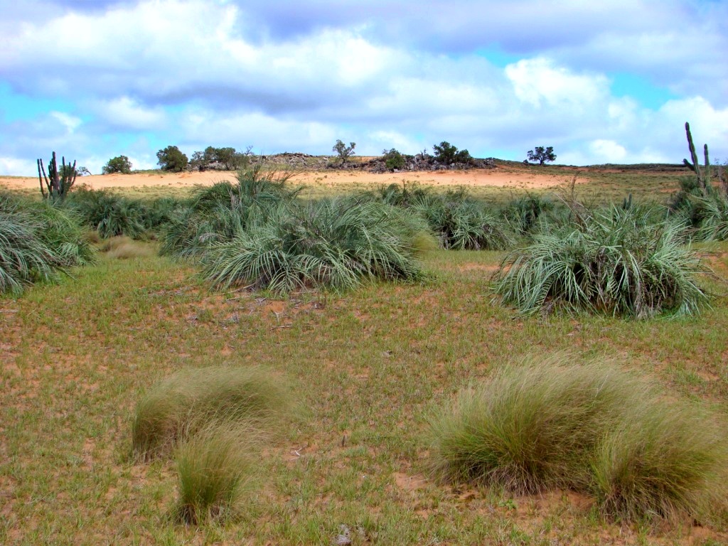
The Pampa is characterized by native herbaceous vegetation consisting of a mixture of grasses and herbs ranging from 5 to 50 cm. In a single square meter of grassland, more than 50 plant species have been found. Woody species such as sub-shrubs and isolated trees may be present, but with low cover.
Researcher Eduardo Vélez, from the MapBiomas Pampa team, comments that the biome suffers from a lack of understanding regarding the importance of this native herbaceous vegetation: " "The lack of exuberance in Pampa grasslands compared to tropical forests means that the loss of this native vegetation does not impact public perception the same way forest deforestation does. However, the ecological importance of grasslands is equivalent to that of forests, being crucial for soil conservation, erosion control, water infiltration, and the presence of pollinators, among many other vital ecosystem services."
The grassland formation is the habitat for grassland fauna, sheltering various plant and animal species, several of which are threatened with extinction. At the same time, it is also used for raising cattle. The plant leaves are consumed by herds (forage), forming the basis of regional livestock activity. Cattle ranching in the Pampa is notable for being an example of sustainable nature use.
Other remarkable characteristics of the Pampa include the absence of a dry season. In the last three decades, every month of the year has had an average monthly precipitation above 100 mm. In contrast to other Brazilian biomes, seasonality is determined by variations in temperature and solar radiation. However, some regions of the Pampa can suffer severe drought effects during years under the La Niña climate phenomenon
With 9% of the biome covered by water, the Pampa is the biome with the highest proportional water surface—largely due to the Laguna dos Patos, the Mirim and Mangueira lagoons, and dozens of coastal lagoons. However, the abundance of water in the coastal zone contrasts with some regions of the biome that have low-flow river hydrography