

Occupying 30% of the Cerrado, Matopiba accounted for 39% of the net loss of native vegetation in the Cerrado between 1985 and 2024
October 1, 2025
The Cerrado, Brazil's second-largest biome, occupying 23.3% of the country (198.5 million hectares), has undergone profound transformations over the last four decades. This is shown in a detailed survey based on MapBiomas Collection 10 of of land cover and land use maps and data in Brazil, which is being launched this Wednesday (October 1). It covers the changes that occurred between 1985 and 2024, when the biome lost 40.5 million hectares of native vegetation, the equivalent of 28% of its original cover. This extension is equal to 1.4 times the area of the Brazilian state of Bahia.
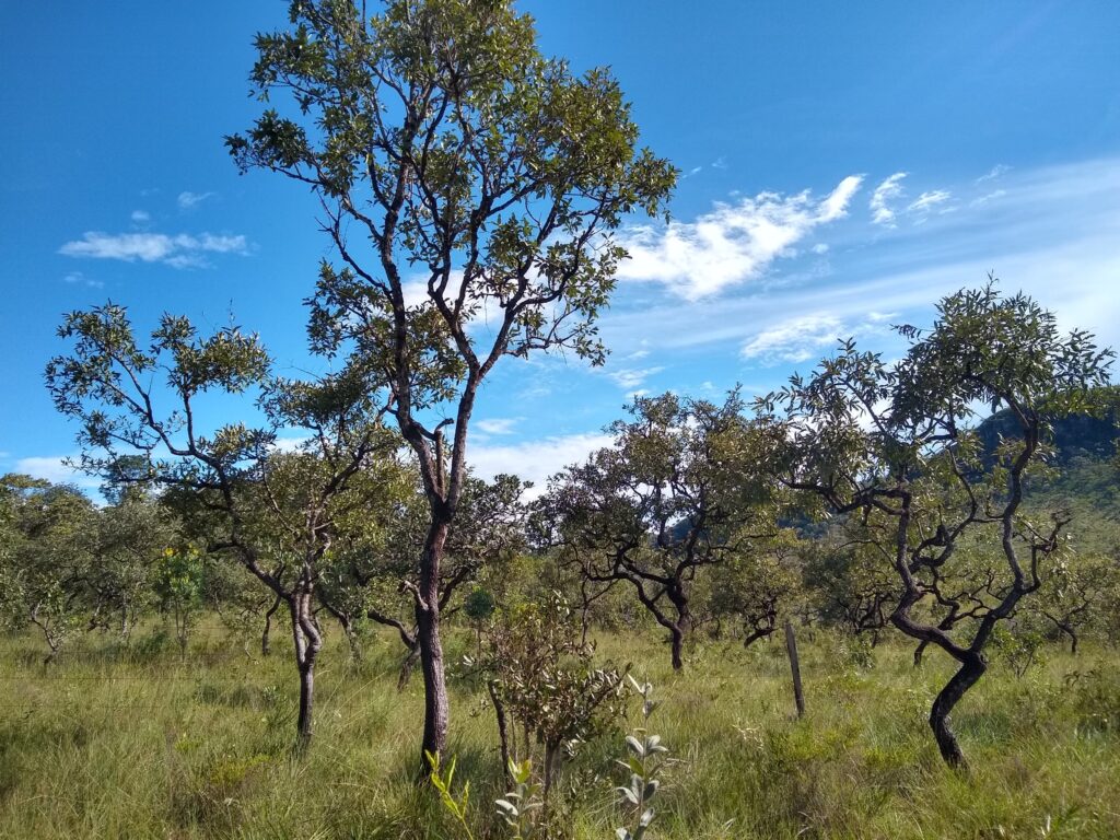
Currently, 47.9% of the Cerrado is occupied by anthropogenic use and 51.2% remains covered by native vegetation. Almost half (47.8%, or 48.6 million) of the remaining native vegetation is concentrated in the region known as Matopiba, formed by the states of Maranhão, Tocantins, Piauí, and Bahia. The Savanna Formation was the type of native vegetation most impacted, losing 26.1 million hectares (32%) in 40 years. Despite this, it is still the predominant natural cover, accounting for 28.4% of the biome
In 1985, 42% of the municipalities in the Cerrado were dominated by farming and ranching; in 2024, this proportion increased to 58% of the municipalities. On the other hand, the percentage of municipalities with more than 80% of native vegetation cover fell from 37% in 1985 to 16% in 2024 – a year in which 24% of the municipalities have less than 20% native vegetation. These percentages consider the proportion of native vegetation in relation to the total area of each municipality.
Matopiba, which occupies 30% of the Cerrado, accounted for 39% (15.7 million hectares) of the net loss of native vegetation in the biome since 1985, becoming a new agricultural frontier. In the last decade (2015-2024), the Cerrado lost 6.4 million hectares of native vegetation, of which 4.7 million hectares were in Matopiba (73%). Over the last 40 years, the agricultural area increased 24 times in the region (+5.5 million hectares).
“The Cerrado has been transformed at an accelerated pace over the last four decades. With increased suppression of native vegetation between 1985 and 1995 and then in the following decades, agriculture expanded and intensified, consolidating the biome as a central region for the country's agricultural production, mainly for grains. More recently, Matopiba has consolidated itself as the main agricultural frontier, concentrating a large part of the recent loss of native vegetation, leaving half of the remaining native vegetation in the biome,” comments Bárbara Costa, research analyst at IPAM and a member of the MapBiomas Cerrado team.
Agricultural expansion in the Cerrado region reaches 74% in four decades
In the Cerrado as a whole, farming and ranching activities grew 74% between 1985 and 2024. Pasture area increased 14.7 million hectares (+44%) in the period, reaching its peak in 2007, with 54.5 million hectares. Even with a 12% reduction compared to this peak, pastures remain the main anthropogenic use, occupying 24.1% of the biome. Forestry also recorded growth, totaling an increase of 2.7 million hectares (+446%) from 1985 to 202
Agriculture, proportionally, was the land use that expanded the most, with a 533% increase (+22.1 million hectares) since 1985. Temporary crops alone increased 21.6 million hectares, now occupying 25.6 million hectares of the Cerrado. Almost half (49%) of Brazil's soybean cultivation area is located in the Cerrado in 2024. Sugarcane cultivation quadrupled between 2003 and 2013, from 600,000 hectares to 2.4 million hectares, with São Paulo, Goiás, and Minas Gerais states accounting for 2.8 million hectares of this crop in the biome in 2024.
Mapped perennial agriculture increased 500,000 hectares (approximately 4 times) in 40 years, now covering 700,000 hectares. More than half (54%) of this perennial agriculture in the Cerrado is destined for coffee, with Minas Gerais concentrating 84% of this crop's area in the biome. The area cultivated with coffee grew 300,000 hectares between 1985 and 2024. Citrus cultivation, which occurs mainly in São Paulo (79% of the citrus area in the biome), also recorded a significant increase of 200,000 hectares (+387%).
In 2024, 1.5 million hectares of native vegetation were deforested in the Cerrado, with 1 million hectares being primary vegetation and 500,000 hectares being secondary vegetation. In the last decade (2015-2024), an average of 73% of deforestation occurred in areas of primary vegetation.
The states with the highest proportion of native vegetation in the Cerrado in 2024 are Piauí (79%), Rondônia (78%), Maranhão (69%), and Tocantins (66%). The states with the lowest proportion of native vegetation in the Cerrado in 2024 are São Paulo (17%), Mato Grosso do Sul (25%), Paraná (34%), and Goiás (36%). Between 1985 and 2024, the area of Cerrado occupied by agriculture in São Paulo increased from 10% to 45%; in Paraná, it increased from 12% to 35%; in Bahia, from 2% to 24%. Between 1985 and 2024, the area of Cerrado occupied by pasture increased from 5% to 40% in Pará; from 36% to 44% in Mato Grosso do Sul; and from 1% to 17% in Maranhão.
Cerrado accounts for one-third of the area covered by photovoltaic power plants
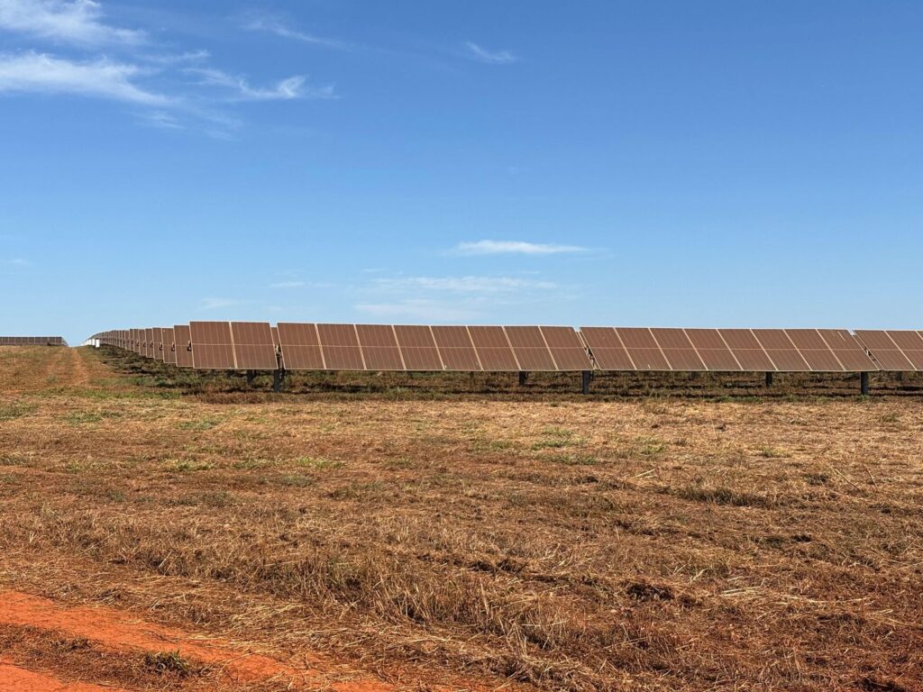
One-third (32%) of the mapped area of photovoltaic power plants in Brazil is in the Cerrado in 2024 (11.3 thousand hectares). There was an increase of 10.5 thousand hectares compared to 2016 (+1273%). Of the total occupied by photovoltaic plants, more than one-third (36%) were savanna formation areas; another third (37%) were pastures. Between 2016 and last year, 4.4 thousand hectares of native vegetation were converted for photovoltaic plants.
Natural water surface area falls almost 30% in 40 years
Although 2024 recorded the largest water surface area since 1985 (1.6 million hectares, or 0.8% of the biome), 60.4% of this area was anthropogenic water surface, such as hydroelectric plants, reservoirs, aquaculture, and mining. The natural water surface retracted 249,000 hectares (-27.8%). The balance of gains and losses in water surface of the Cerrado river basins shows that 90.8% of the river basins suffered losses of natural water surface, however 68.5% gained anthropogenic water surface area. Even so, 26% of the river basins lost both natural and anthropogenic water surface area.
“Water resources are also under pressure in the Cerrado. Considering that more than half of the biome is in rural properties, it is fundamental to promote incentives and public policies that reconcile production, conservation, and recovery of native vegetation. Only in this way will it be possible to guarantee Brazil's water, food, and climate security,” highlights Ane Alencar, Director of Science at IPAM and coordinator of the Cerrado and Fire teams at MapBiomas.
Land categories and protected areas
Indigenous Territories (97%), Military Areas (95%), and Conservation Units (94%) have the highest percentages of native vegetation in the Cerrado. In contrast, lands without land registration (49%), rural properties (45%), and urban areas (7%) have less than half of native vegetation.
Private areas with georeferenced land registration occupy 129 million hectares (65% of the biome), while public lands or lands without georeferenced land registration account for 53 million hectares (27%). Protected areas or areas of collective use cover 14 million hectares (7%). Of the total properties with the Rural Environmental Registry (CAR) in Brazil, 16.9% are in the Cerrado (1.2 million).