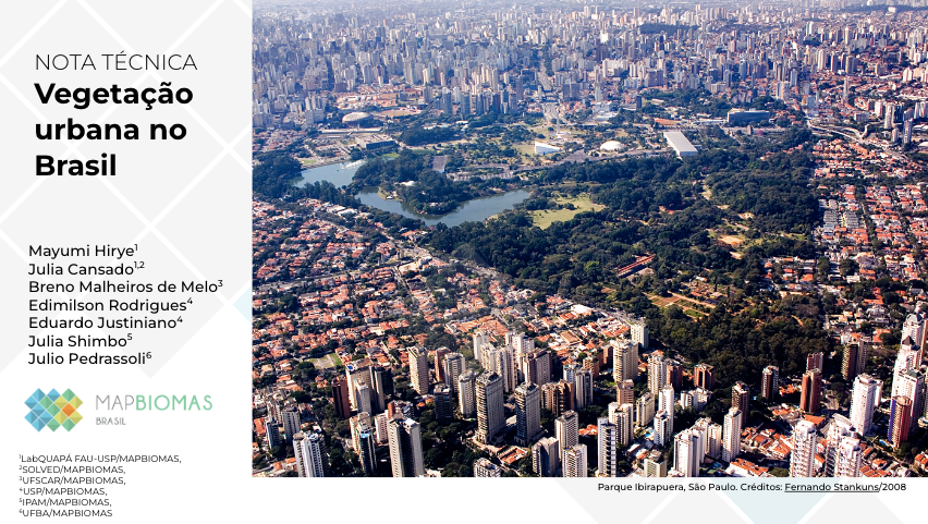
Cities located in the Atlantic Forest account for more than half the area of vegetation and squares in the whole country
July 18th, 2024
An unprecedented survey by MapBiomas shows that 6.9% of urban areas in Brazil are covered by vegetation. This corresponds to 283,700 hectares. Of this total, 61.5%, or 174,599 hectares, are in the Atlantic Forest. Approximately one in five hectares (22%) are in the Cerrado, where 62,533 hectares of vegetation were identified. The remaining 16.5% is divided between the Amazon (18,605 hectares, or 6.6% of the total), the Caatinga (16,139 hectares - 5.7%), the Pampa (11,228 hectares - 4%) and the Pantanal (587 hectares - 0.2%).
In the Atlantic Forest, the municipality with the largest area of vegetation is Rio de Janeiro, with 12,378 hectares - more than double that of Brasília, the city with the largest urban area of vegetation in the Cerrado biome (6,125 hectares). In the Amazon, Manaus takes the lead (2,818 hectares). With 1,940 hectares of vegetation, Canoas is the city with the largest urban area of vegetation in the Pampa. In the Caatinga, this title goes to Fortaleza (1,063 hectares) and, in the Pantanal, to Corumbá (253 hectares).
“Data on urban vegetation has the potential to contribute to sustainable urban planning and management, allowing vegetation to be effectively integrated as an essential part of the urban fabric,” says Julio Pedrassoli, from MapBiomas' urban area mapping team.
To arrive at these results, the researchers used data from the Beta MapBiomas 10m Collection, with images from the Sentinel satellites with a spatial resolution of 10m, which were complemented with detailed information on squares and other mapped urban green spaces available on Open Street Map. In this way, it was possible to quantify urban vegetation by municipality, state and biome, identifying not only squares and large clumps of vegetation within urbanized areas, but also peri-urban vegetation around cities. The latter is 10 times larger than urban vegetation: 2,632,779 hectares throughout Brazil. Once again, the Atlantic Forest leads the way with 1,083,427 hectares, followed by the Cerrado (528,688 hectares), the Amazon (456,844 hectares), the Caatinga (376,983 hectares), the Pampa (177,472 hectares) and the Pantanal (9,366 hectares).
As all Brazilian municipalities have at least one mapped square, the researchers also measured the extent that they occupy the urban perimeters. More than half (55.7%) of the square areas in Brazil are in cities located in the Atlantic Forest biome. Almost a quarter (23%) are in the Cerrado. The other biomes account for less than 10% each: 8.5% in the case of the Amazon, 7.6% in the Caatinga, 5.1% in the Pampa and 0.1% in the Pantanal. Although the data mapped on Open Street Maps is incomplete, as the platform receives new collaborations over time, it is able to give us a broad picture of how the squares are distributed in the different regions of the country.
Urban and peri-urban green spaces have received increasing interest because they are officially recognized as providers of ecosystem services that can help achieve the Sustainable Development Goals (SDGs) - especially SDG 11, which aims to make cities and human settlements inclusive, safe, resilient and sustainable. The importance of these services was recognized in a recent law establishing the Green and Resilient Cities Program of the federal government: in item I of article 2, the text mentions the role of urban green areas in ecosystem services and adaptation to climate change. In technical noteMapBiomas researchers explain that urban vegetation regulates the microclimate, contributes to drainage systems and provides habitat for urban fauna. In addition, vegetation is also an important factor in human well-being, providing green spaces for leisure and physical activity.
Urban vegetation includes species of herbaceous vegetation, shrubs and small, medium and large trees, which can be located in parks and squares, Conservation Units such as Permanent Preservation Areas (PPAs), cemeteries, sports fields and abandoned areas. However, throughout the country, herbaceous or small vegetation prevails, ranging from 51% to 67% of the total.


