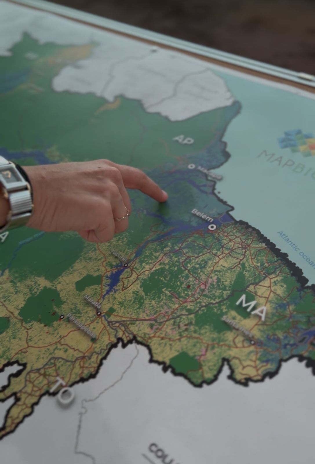


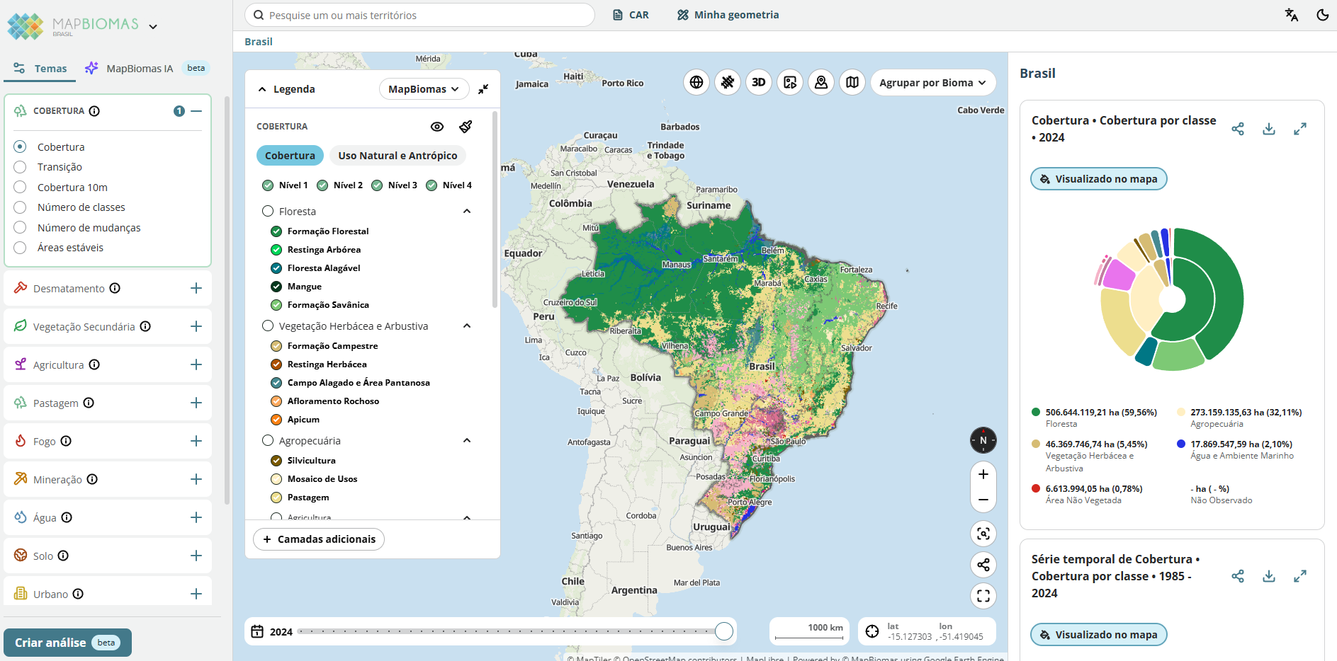
Maps produced from pixel-by-pixel classification of Landsat images, segmented by biome, state, and municipality.
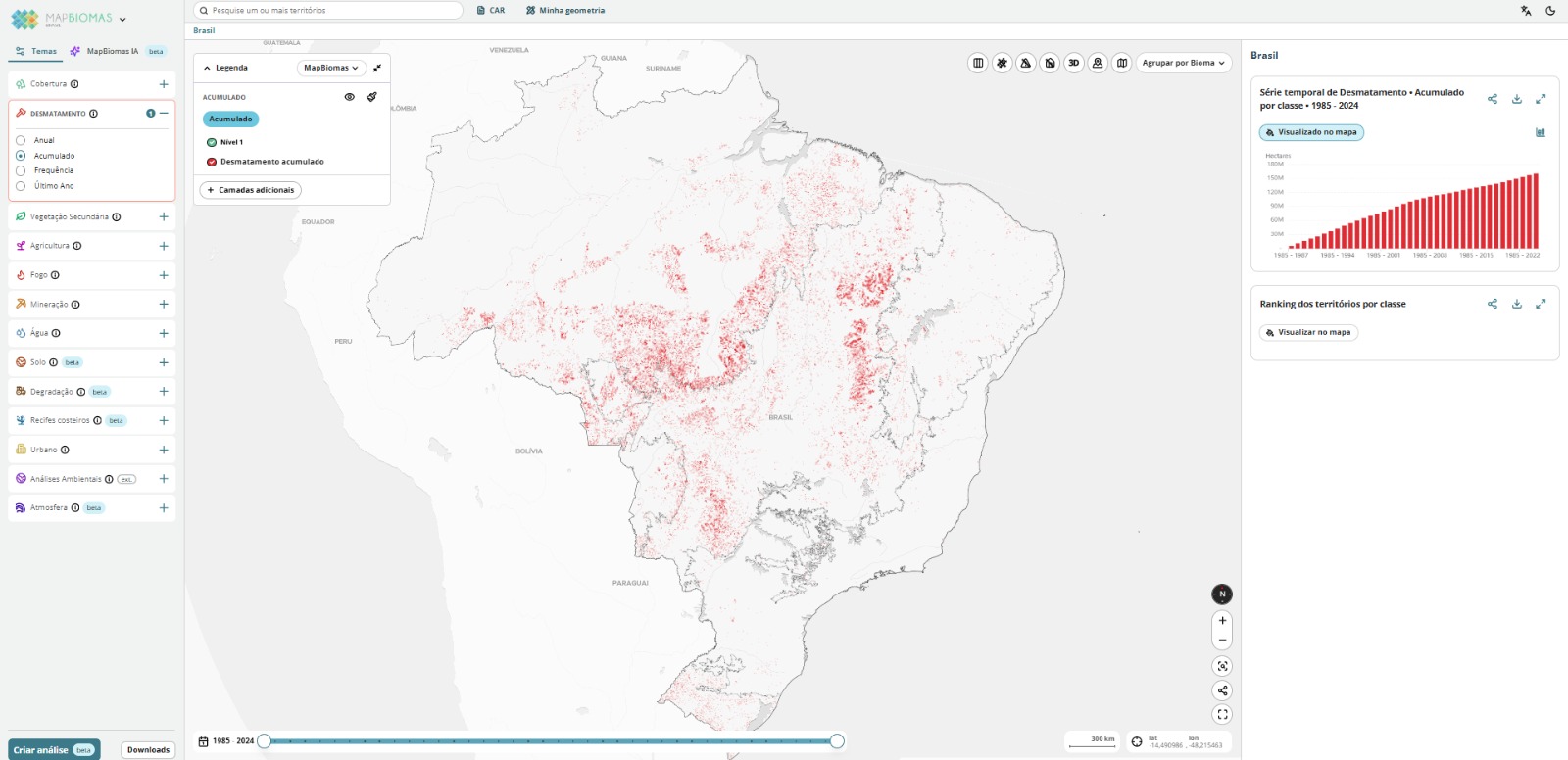
Dados anuais de supressão de florestas e vegetação natural não florestal, gerados a partir da análise do histórico de pixels, com resolução espacial de 30 m.
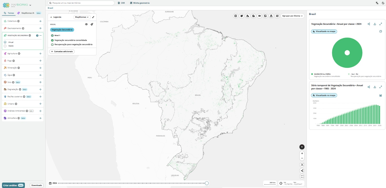
Mapas anuais e da idade da vegetação secundária em áreas de floresta e de vegetação herbácea e arbustiva no Brasil desde 1985 até 2023
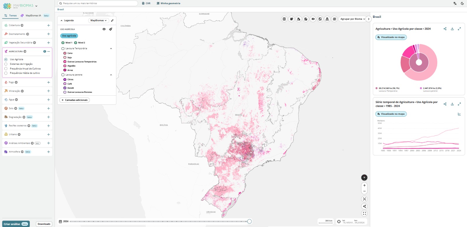
Annual maps of the country's main agricultural crops and irrigated agriculture since 1985, as well as the planting frequency of temporary agriculture (2017-2023)
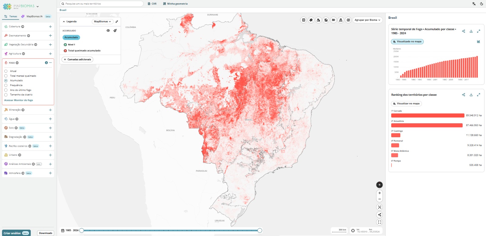
Mapping of fire scars in Brazil based on mosaics of Landsat satellite images with a spatial resolution of 30 meters, covering the period from 1985 to 2023, with monthly and annual data on burn scars across Brazilian territory.
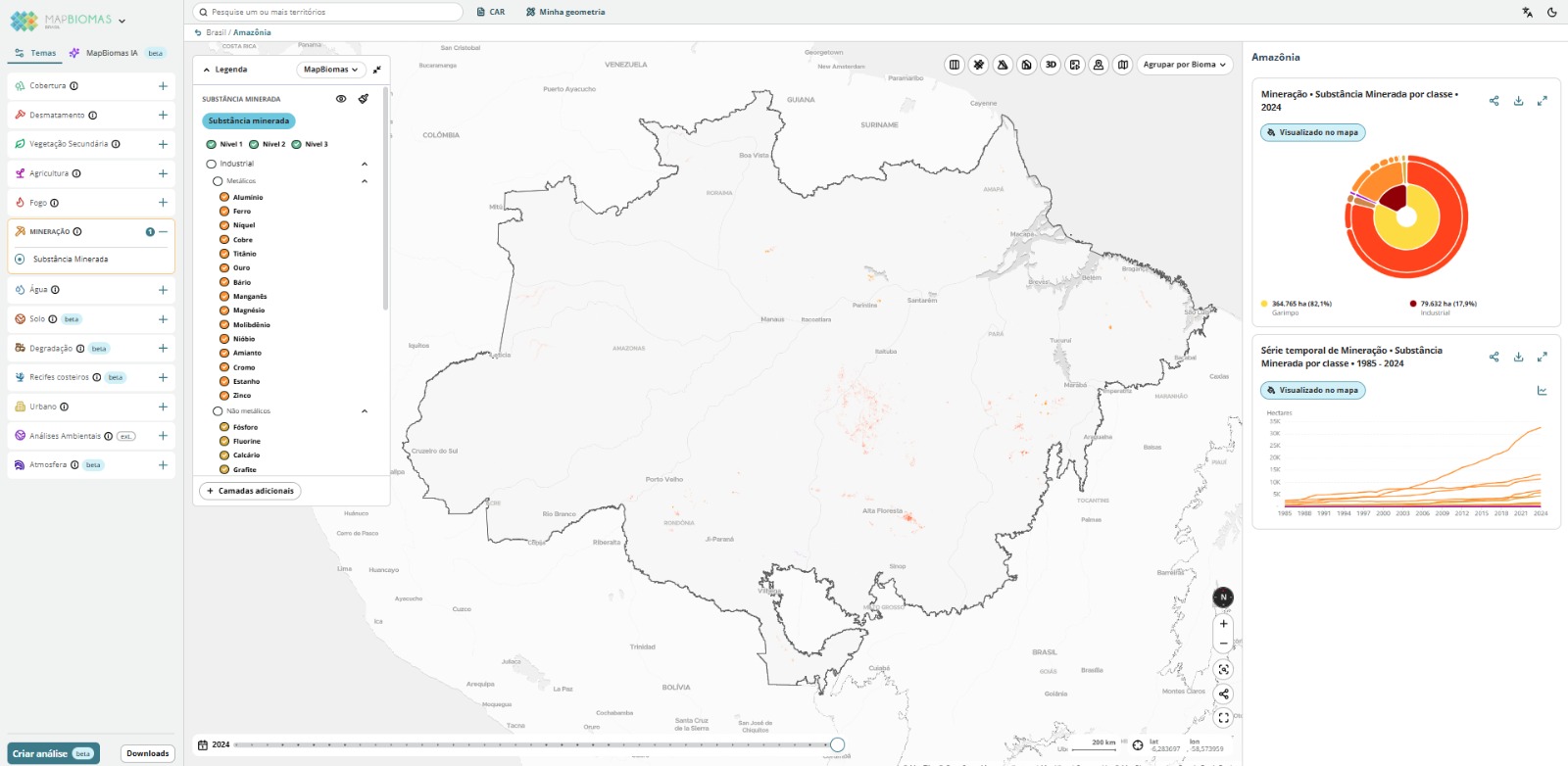
Mapping of industrial mining and artisanal mining locations, focusing on areas of known mining projects. Deep Learning techniques are used, and the reference data comes from multiple sources related to mining projects.
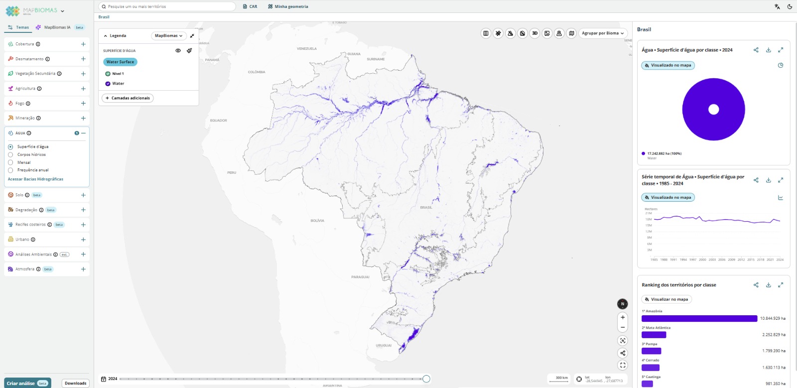
Monthly and annual data on the dynamics of water bodies and surface water across the national territory, mapped from 1985 to 2023 using Landsat satellite scenes with up to 70% cloud cover and a spatial resolution of 30 meters.
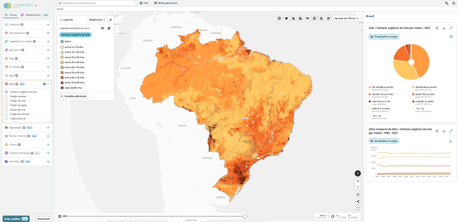
Mapas anuais de carbono orgânico do solo (COS) no Brasil entre 1985 a 2023, além de mapas de textura do solo (areia, silte e argila).
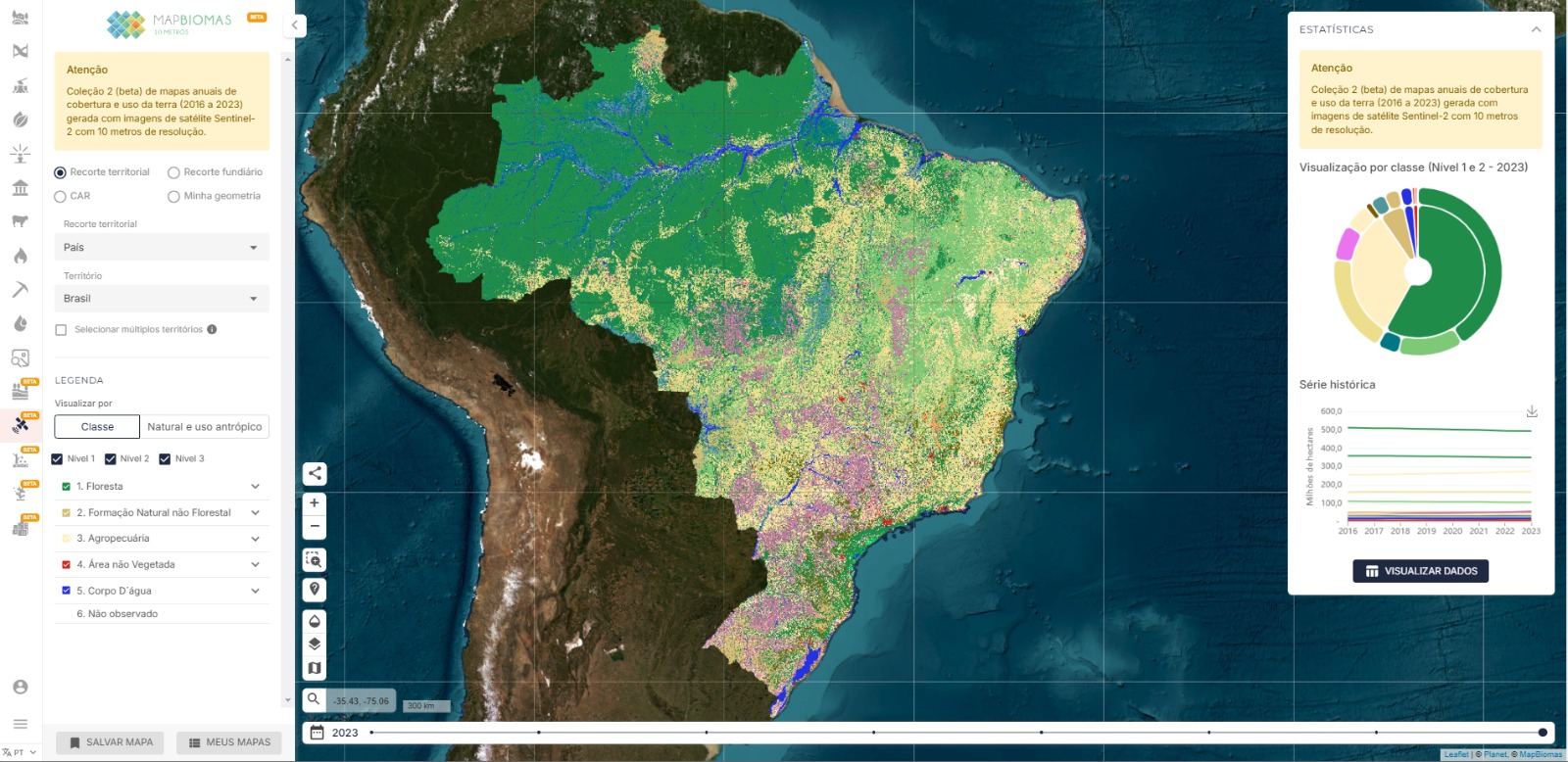
Mapas anuais de Cobertura e Uso da Terra, no período de 2016-2023, com imagens do satélite Sentinel-2, com resolução espacial de 10 metros.
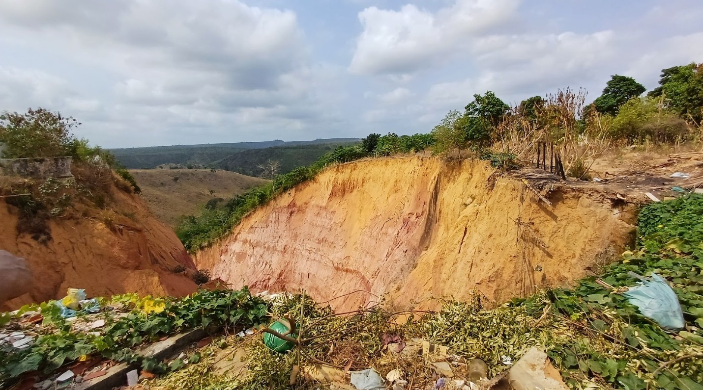
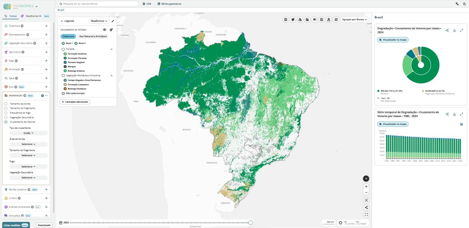
Analysis of the degradation vectors of native vegetation from 1986 to 2021, including data such as size and isolation of native vegetation fragments, edge area, fire frequency, and time since the last burn.
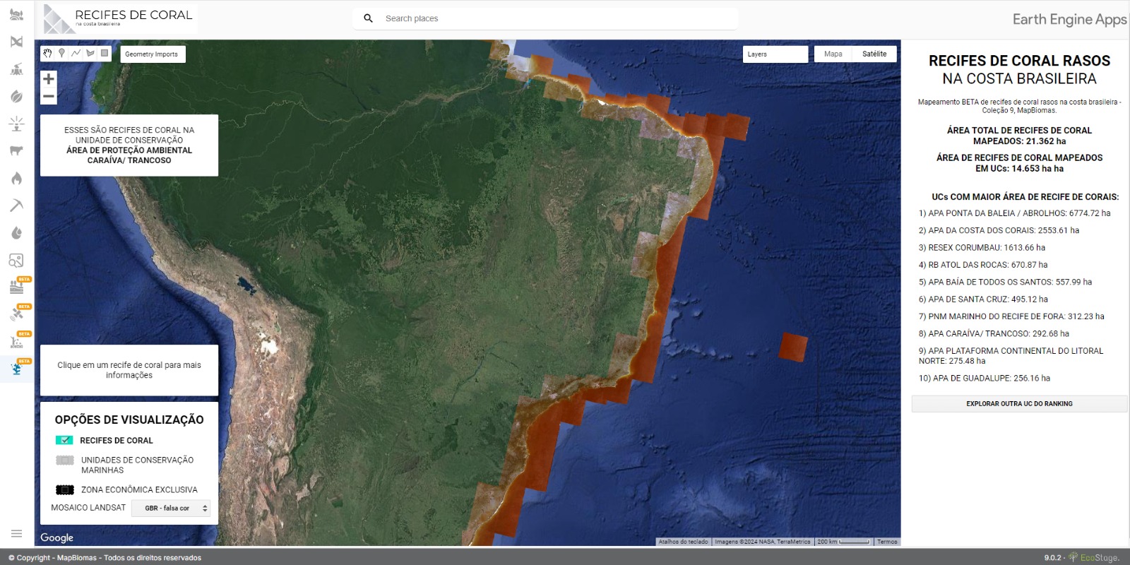
Beta mapping of coral reefs found in shallow, clear waters along the Brazilian coast, using Landsat satellite scenes. Deep and mesophotic reefs cannot be identified via satellites due to water depth and turbidity.
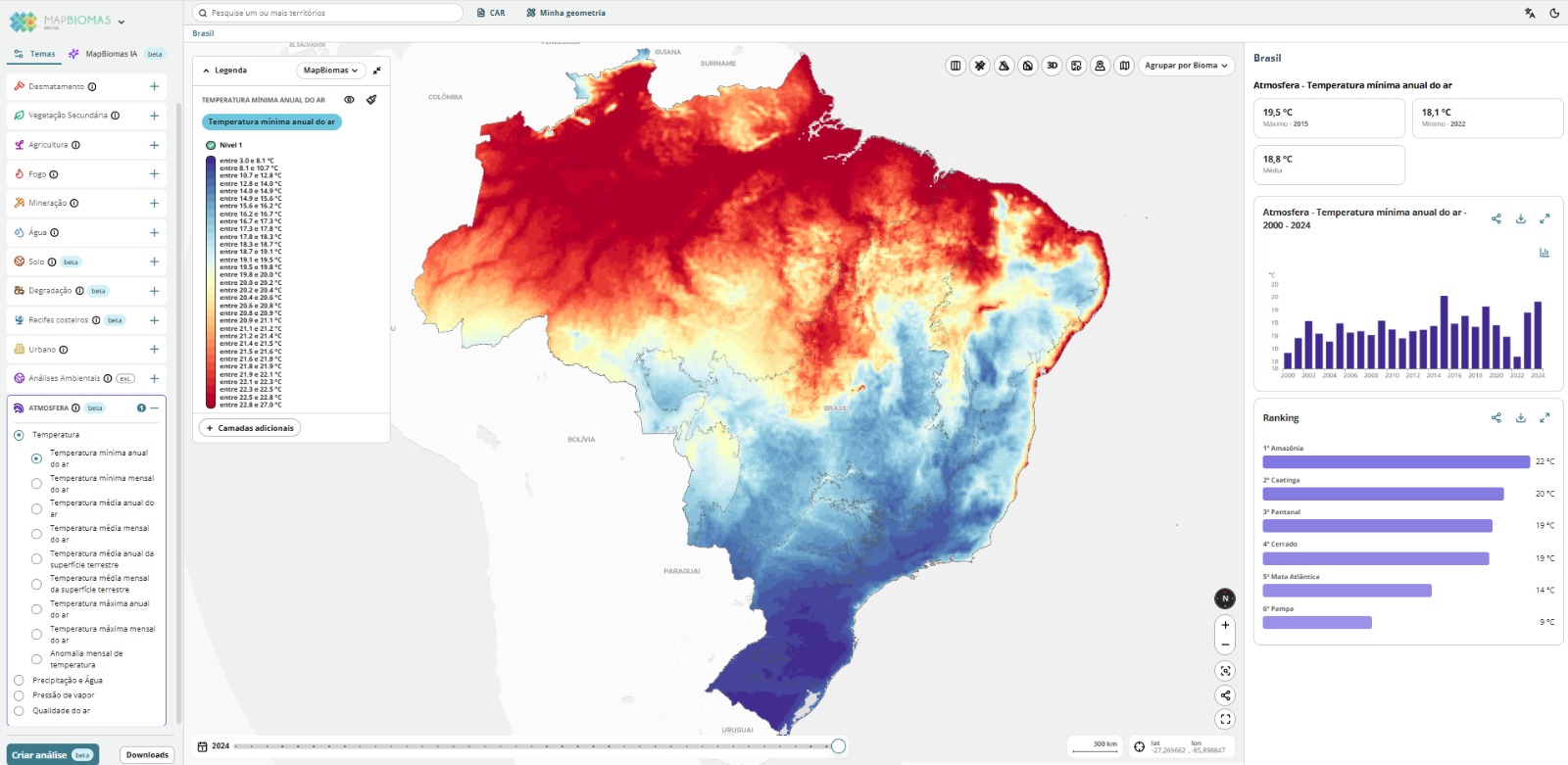
Dados climáticos e de poluentes 1985 a 2024 atmosféricos no Brasil.
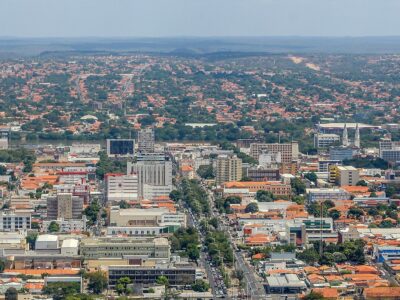
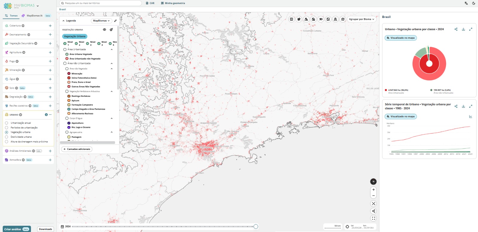
Mapas das áreas urbanizadas e da vegetação dentro e no entorno das cidades, além das áreas de risco, favelas, declividade e proximidade a drenagens, com recortes territoriais de regiões metropolitanas, concentrações urbanas e setores urbanos e rurais


Receive our news and stay on top of everything that happens in the project.