

Cocoa is the main agricultural crop in southern Bahia. In addition to its economic importance in the region, the maintenance of tree cover, under which most cocoa is produced in the state, brings benefits for the maintenance of ecosystem services such as the conservation of biodiversity, carbon stock, and the hydrological cycle. In this context, the MAPBIOMAS CACAU proposed to address the technical challenge of mapping shaded cocoa areas, separating them from those covered by unmanaged native vegetation
In July 2023, MapBiomas Cacau launched the shaded cocoa cultivation map covering 83 municipalities in southern Bahia. In this phase, the initiative received funding from CocoaAction Brazil, Instituto Arapyaú, and the Bahia State Public Ministry, with collaboration from researchers, students, and staff from UESC, CEPLAC, PCTSB, CIC, UFSB, and Tabôa Community Strengthening.
The methods and results of this mapping version can be accessed in this report.
Similar to other data generated by the MapBiomas network, the shaded cocoa mapping is a work in progress and still has several imperfections. The mapped shaded cocoa area is an estimate and should be used with caution due to the similarity between areas of productive cultivation on the image date and abandoned cocoa plantations, among other factors. Read section 4E of the report to learn more about the data's characteristics and limitations.
The mapping can also be accessed using this script or directly through the asset on GEE:
‘projects/mapbiomas-public/assets/brazil/lulc/collection7_1/mapbiomas_cacau_2019_v1’
Ou acessar pelo link do GEE.
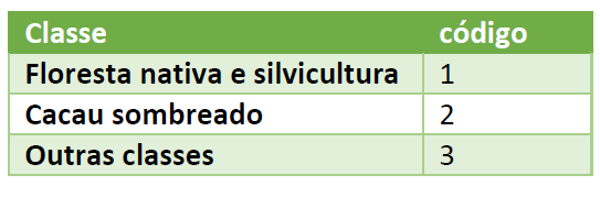
The map uses the following legend codes:
MapBiomas data is public, open and free under the Creative Commons CC-BY license and with reference to the source in the following format:
“MapBiomas Cacau – Mapping of Shaded Cocoa Cultivation in Southern Bahia, accessed on [date] through the link: [LINK]”
If you have suggestions, critiques, and ideas to improve the work, please contact us at: contato@mapbiomas.org