Novo levantamento do MapBiomas também mostra expansão das favelas e perda de áreas de vegetação urbana em todo o Brasil
08 de novembro de 2024
As áreas urbanizadas no Brasil somam 4,1 milhões de hectares, ou 0,5% do território nacional, em 2023. Desde 1985, o crescimento foi de 2,4 milhões de hectares a um ritmo de 2,4% ao ano. Porém áreas de encostas, mais suscetíveis a deslizamentos, tiveram um crescimento maior no período: 3,3% ao ano, sendo que 70% desta ocupação nas encostas aconteceu nos últimos 38 anos. Os dados são do mais recente levantamento do MapBiomas sobre o perfil da ocupação e uso do solo nas áreas urbanas e seu entorno (áreas periurbanas). Para isso foram cruzados os dados da Coleção 9 de Mapas de Cobertura e Uso da Terra no Brasil produzido pelo MapBiomas com limites de setores urbanos dos municípios brasileiros do IBGE.
Embora exista uma Lei Federal (6766/79) que não permite o parcelamento do solo urbano em encostas, ou seja, em terrenos com declividade superior a 30%, o levantamento encontrou 47,6 mil hectares de áreas urbanas nessas condições – dos quais 33,2 mil hectares foram ocupados entre 1985 e 2023. A maioria (93,6%) fica em cidades localizadas na Mata Atlântica.
>> Confira o Fact Sheet complhttps://brasil.mapbiomas.org/wp-content/uploads/sites/4/2024/12/Factsheet-Areas-Urbanizadas_C9_25.11.pdfeto
“O mapeamento dessas áreas é muito importante para gestores públicos, principalmente agora, às vésperas da estação chuvosa em todo o Brasil, para que medidas preventivas sejam planejadas e direcionadas para as regiões mais vulneráveis”, explica Julio Pedrassoli, da equipe de mapeamento de áreas urbanas do MapBiomas. “Como todos os dados do MapBiomas estão disponíveis gratuitamente na internet, gestores públicos podem fazer uso destas informações para evitar graves consequências de deslizamentos na época das chuvas, como infelizmente já vimos no passado”, acrescenta. Vale lembrar que em 2024 o governo federal abriu a consulta pública para o desenvolvimento dos planos de adaptação climática para as cidades. Este ano será ainda a primeira vez que o IPCC está trabalhando em um relatório específico sobre o impacto das mudanças climáticas nas áreas urbanas. “Os dados do MapBiomas e do módulo urbano têm potencial de contribuição, pelo menos, nestas duas instâncias”, completa Mayumi Hirye, da equipe das áreas urbanas do MapBiomas.
Dos 47,6 mil hectares de áreas urbanas mapeadas com declividades superiores a 30%, 37,8 mil hectares ficam no Sudeste. Os maiores aumentos de áreas urbanas em encostas entre 1985 e 2023 se deram no Rio de Janeiro (+811 hectares), São Paulo (+820 hectares), Belo Horizonte (+532 hectares), Salvador (+397 hectares) e Maceió (+180 hectares). As capitais somam um aumento de 3,3 mil hectares. As cinco capitais brasileiras com áreas urbanas em declividades superiores a 30% são Rio de Janeiro (2.695 hectares), São Paulo (1.525 hectares), Belo Horizonte (1.343 hectares), Salvador (739 hectares) e Florianópolis (331 hectares).
Outro alerta para gestores municipais é o crescimento da área urbana perto de rios e córregos: de cada quatro hectares de crescimento urbano entre 1985 e 2023, um foi em áreas que ficam a três metros verticais ou menos de rios ou córregos – e, portanto, vulneráveis a inundações. Esse dado mostra quanto uma construção está longe de onde a água pode chegar. Foram 648 mil hectares de expansão, ou um pouco mais de 25% do crescimento total no período. Em 2023, as áreas urbanas a três metros ou menos de rios e córregos totalizavam 1,14 milhão de hectares – 26,6% do total de áreas urbanas no país. Mais da metade (56,7%) dessa ocupação próxima aos rios aconteceu nos últimos 38 anos. Áreas desse tipo podem estar mais sujeitas a efeitos de eventos extremos, como os ocorridos entre abril e maio de 2024 no Rio Grande do Sul e mapeados pelo MapBiomas.
Em 2023 as áreas urbanas localizadas em regiões de risco somaram 115 mil hectares – um aumento de 60,9 mil hectares de 1985 a 2023. O Sudeste concentra 48,4% das áreas de risco no país. Minas Gerais, São Paulo, Santa Catarina, Pernambuco e Bahia são os cinco estados com maior proporção de áreas de risco em relação à área urbana em 2023.
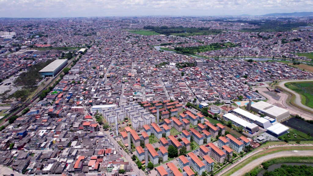
O mapeamento também constatou crescimento das áreas de favelas. Elas representam 4,2% das áreas urbanas no Brasil e cresceram 104,7 mil hectares entre 1985 (75,2 mil hectares) e 2023 (180,1 mil hectares). A expansão no período tem sido de 2.760 hectares ao ano. Isso significa que a cada quatro anos elas crescem o equivalente a uma cidade como Lisboa, em Portugal.
O Norte concentra 24% do total da área urbana em favelas no Brasil. Porém entre os cinco estados líderes em termos de proporção de favelas em relação a área urbana em 2023, três são do Sudeste: São Paulo, Pará, Rio de Janeiro, Espírito Santo e Amazonas.
Áreas de vegetação urbana em expansão
As coberturas antrópicas da terra correspondiam a 63% dos setores urbanos em 1985; em 2023, essa participação aumentou para 74%. Paralelamente, as áreas naturais no entorno das cidades (tais como florestas, praias, dunas etc.) diminuíram de 37% para 26% nesses 38 anos, o que representa a perda de 1,15 milhões de hectares. A partir de 1990, as áreas urbanizadas passaram a ser o uso predominante das áreas não vegetadas brasileiras, ultrapassando 50% do total, e em 2023 representavam 61% de toda a área não vegetada no Brasil. Nesse ano, a vegetação no interior das cidades totalizou 630,9 mil hectares. A média da vegetação nas cidades brasileiras é de 11%.
O mapeamento constatou que as áreas de vegetação urbana (aquela que acontece dentro das áreas urbanas) têm aumentado em média 4,8% ao ano entre 1985 e 2023 – ritmo maior que os 2,1% ao ano da expansão das áreas não vegetadas nesse período.
Apesar de mais da metade (52,7%) das áreas urbanas vegetadas ficarem na Mata Atlântica, os cinco estados com maior proporção de vegetação urbana são de outros biomas: Acre, Amazonas, Distrito Federal, Maranhão e Pará. Também quatro das cinco capitais com maior proporção de vegetação urbana ficam fora da Mata Atlântica: Rio Branco (AC), Salvador (BA), Vitória (ES), Florianópolis (SC) e São Luís (MA). Rio Branco lidera também o ranking das capitais que mais perderam vegetação urbana nos últimos 20 anos (de 43,3% em 2003 para 32,8% em 2023), seguida por São Luís (de 30,8% para 23%) e Boa Vista (de 21% para 13,9%). Ao todo, as capitais de estados no Brasil perderam 4,3 mil hectares de vegetação urbana nos últimos 20 anos.