

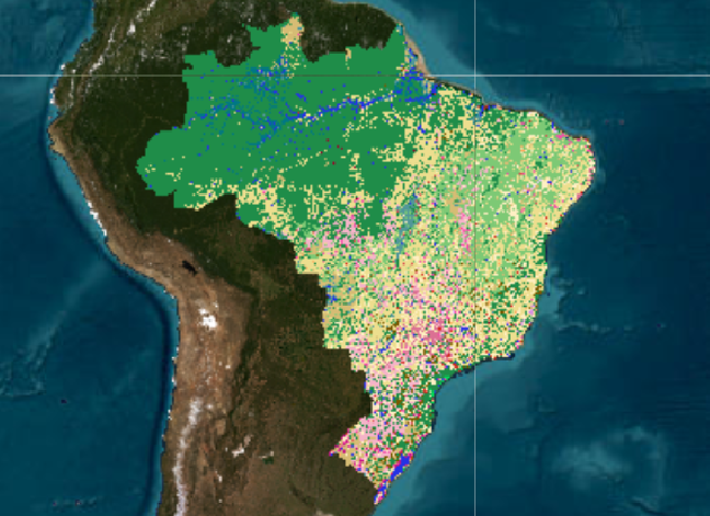
The MapBiomas Collection 8 of Brazil's annual maps of land cover and land use covers the period from 1985 to 2022 on a 30 m spatial resolution. This new collection has some improvements in accuracy in the biomes and two new classes (Floodable Forest and Palm Oil), mapping 29 classes.
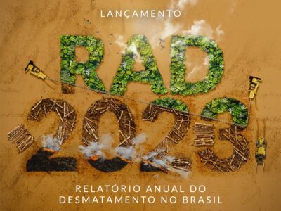
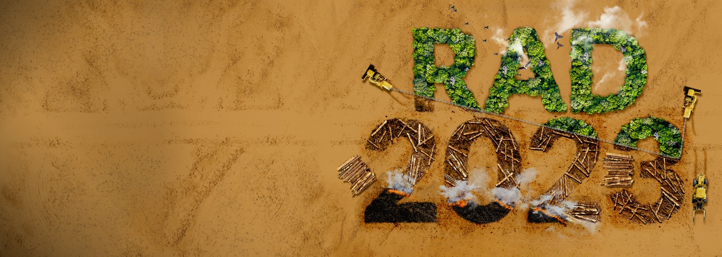
Deforestation and secondary vegetation growth data for all Brazilian biomes from 1987 to 2021, including classification between native vegetation types and successional stage - primary or secondary native vegetation.
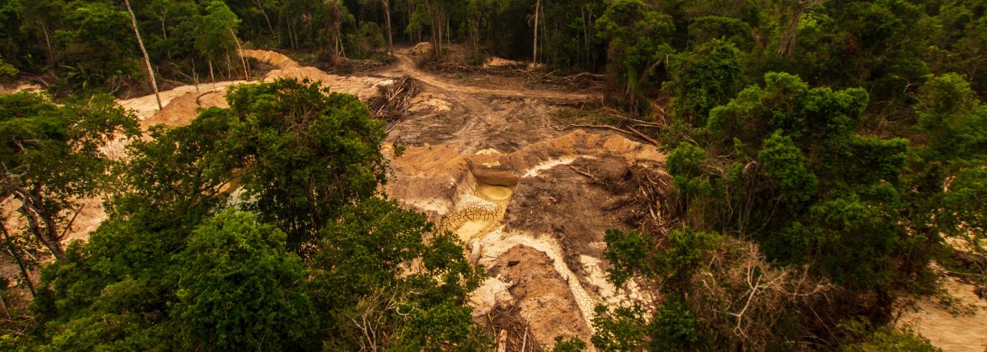
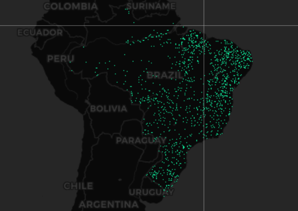
New data published on the evolution of industrial mining and mining areas from 1985 to 2022.
Check out new features and layers of information, such as the evolution of the irrigation area and the evaluation of pasture quality in Brazil.
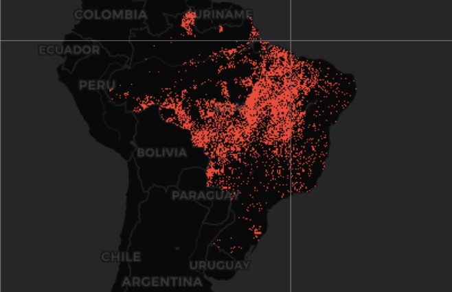
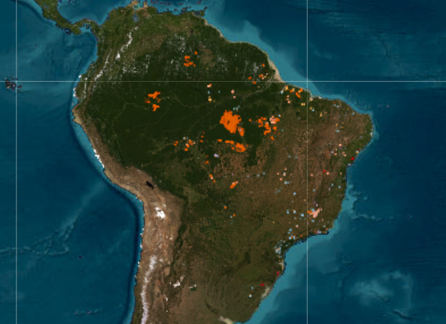
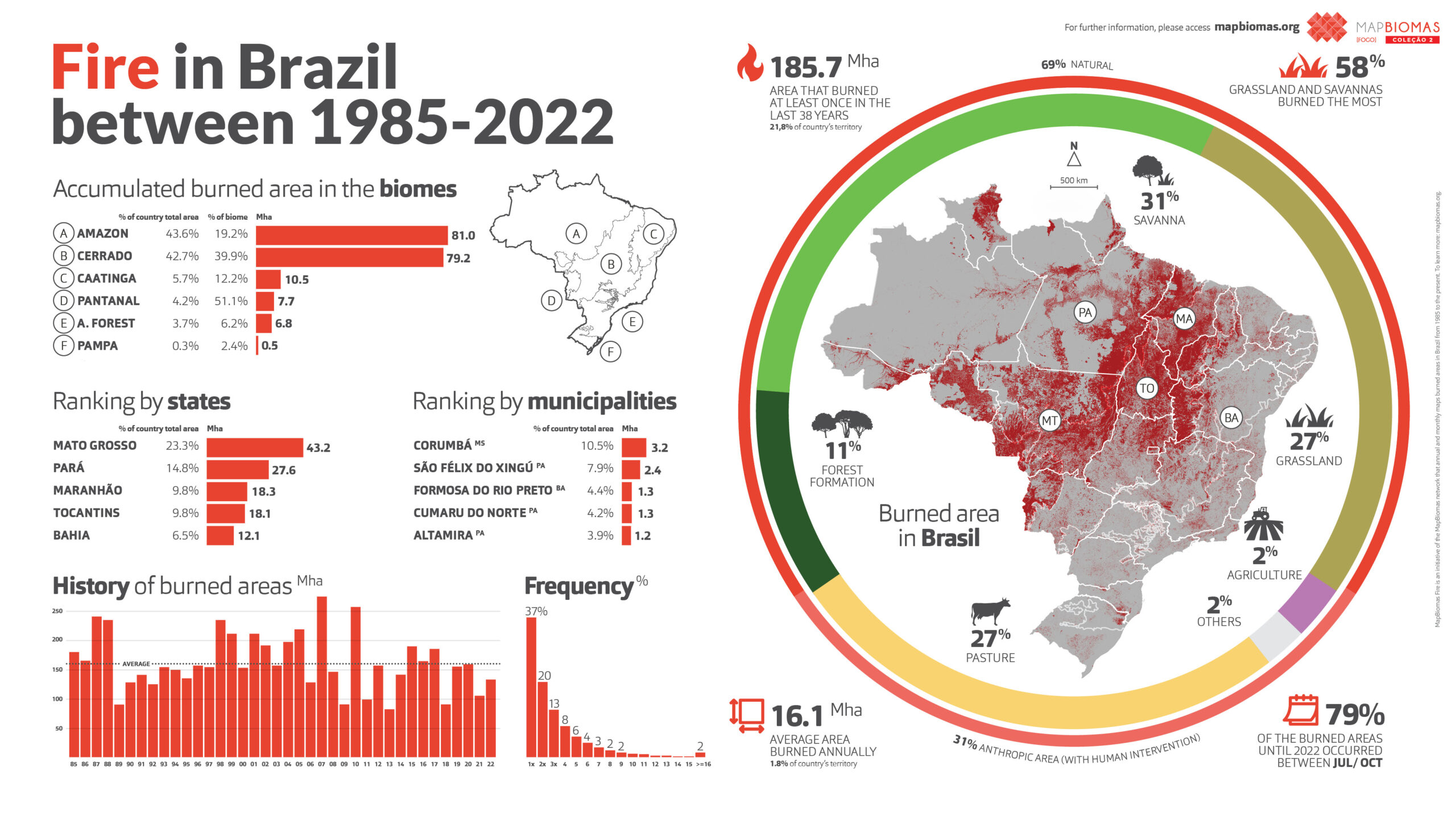
Data from Collection 2 of MapBiomas Fogo present the impacts of fire on the national territory over 37 years (1985 and 2022), with annual and monthly data, frequency, and accumulated burned area.
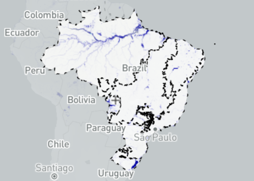
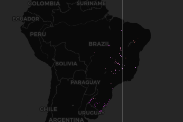
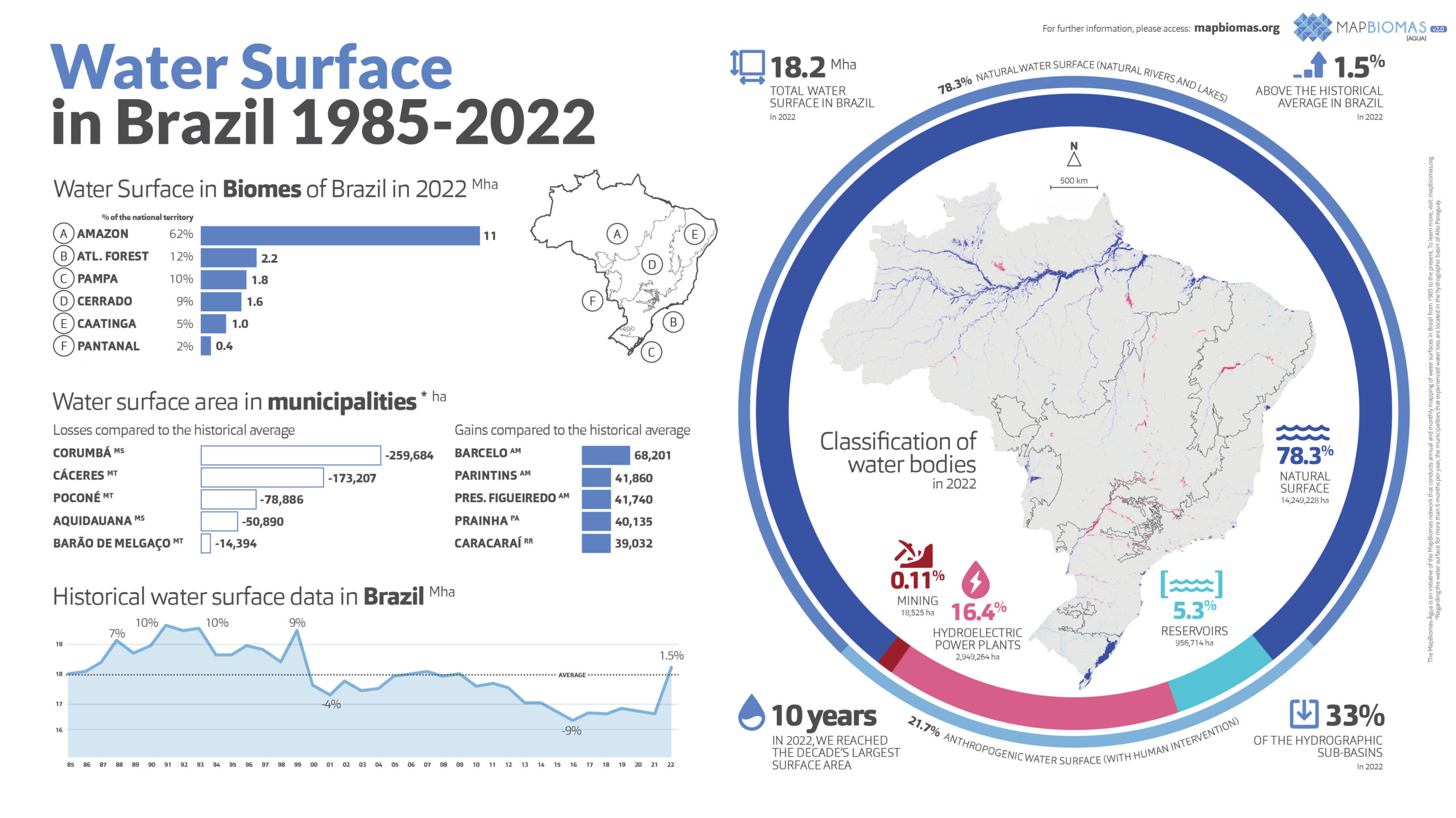
Besides the water surface gain in 2022, the data of MapBiomas' Collection 2, from 1985 to 2022, indicate a loss tendency in the water surface at all Brazil's watershed regions.
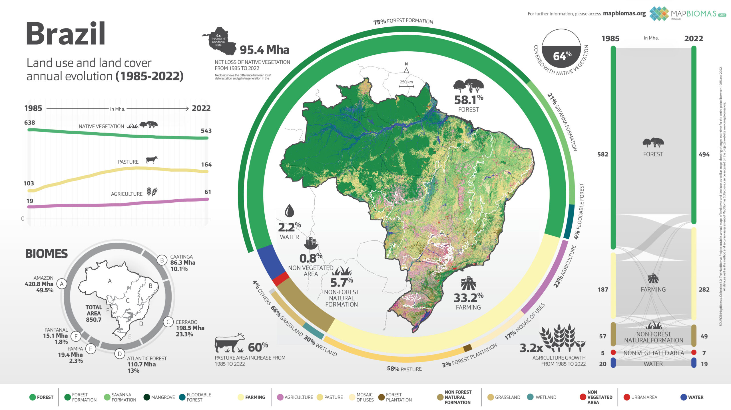
Brazil
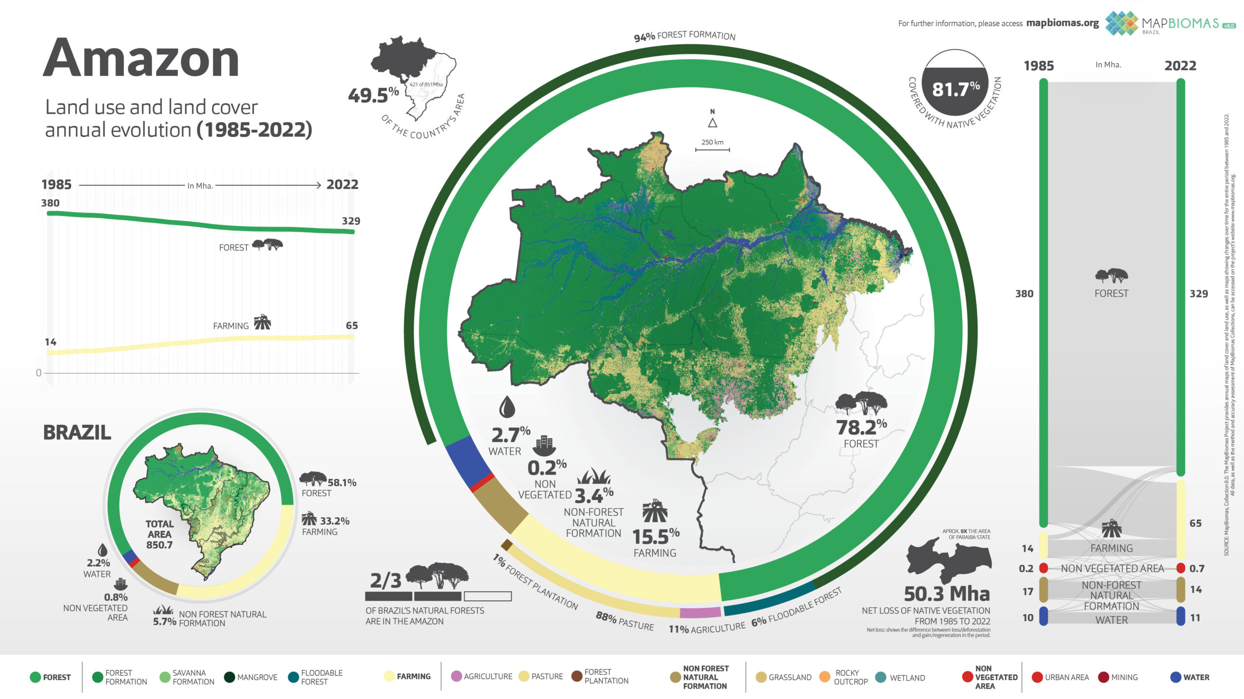
Amazon
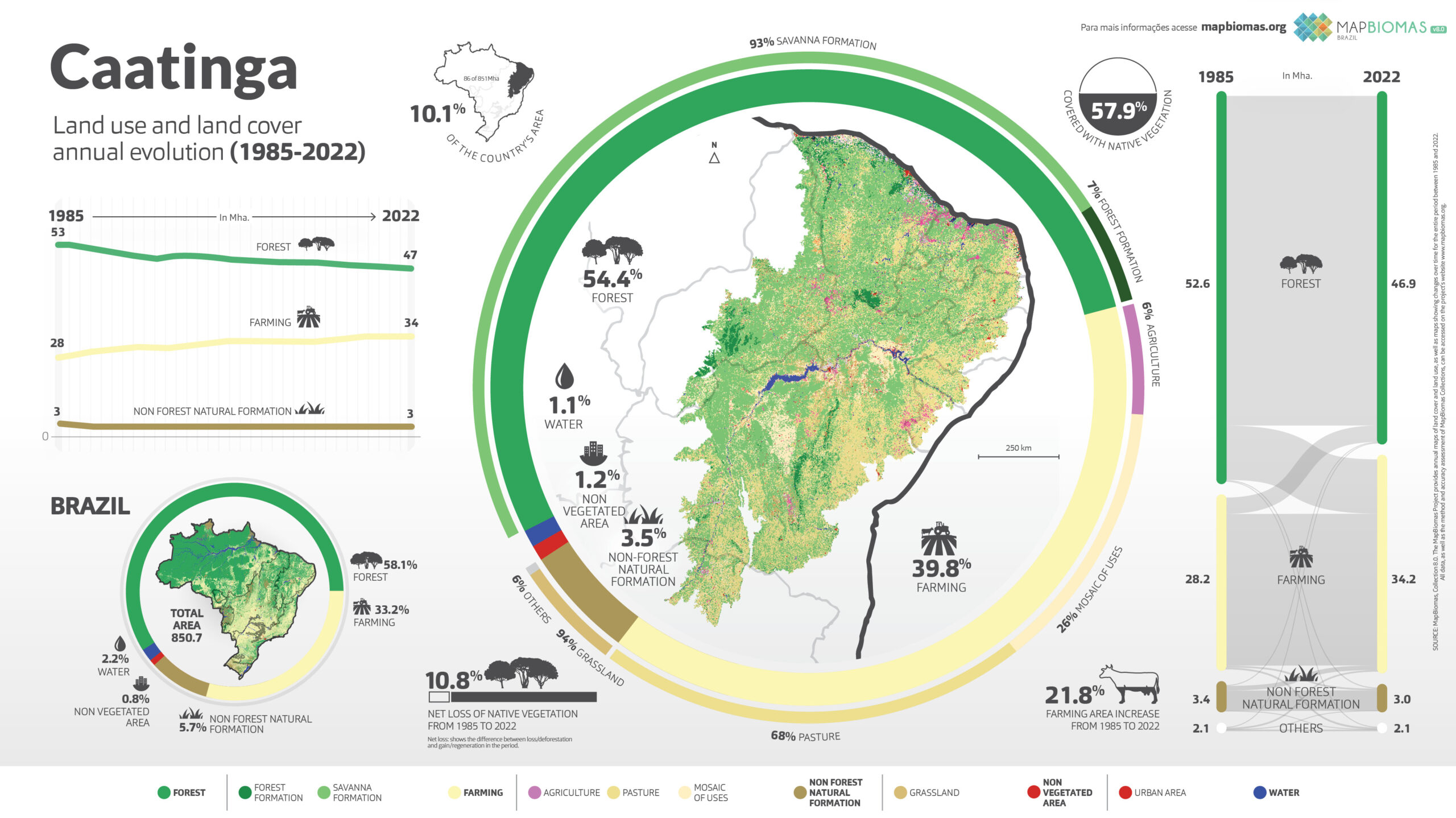
Caatinga
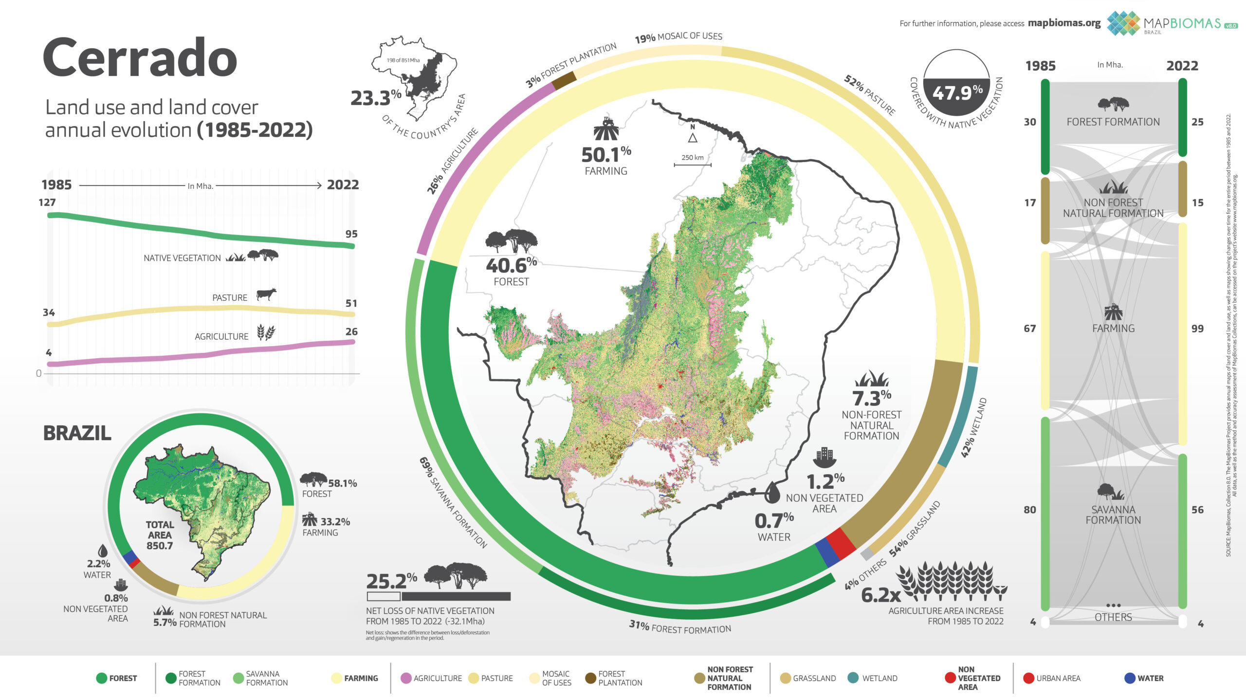
Cerrado
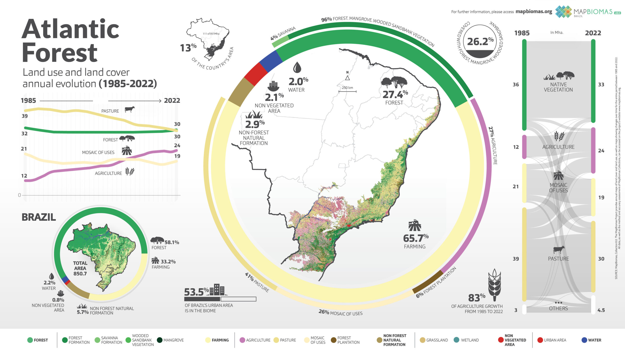
Atlantic Forest
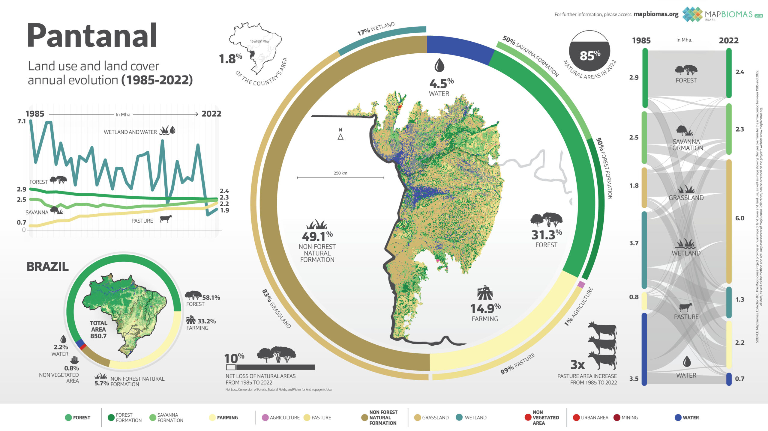
Pantanal
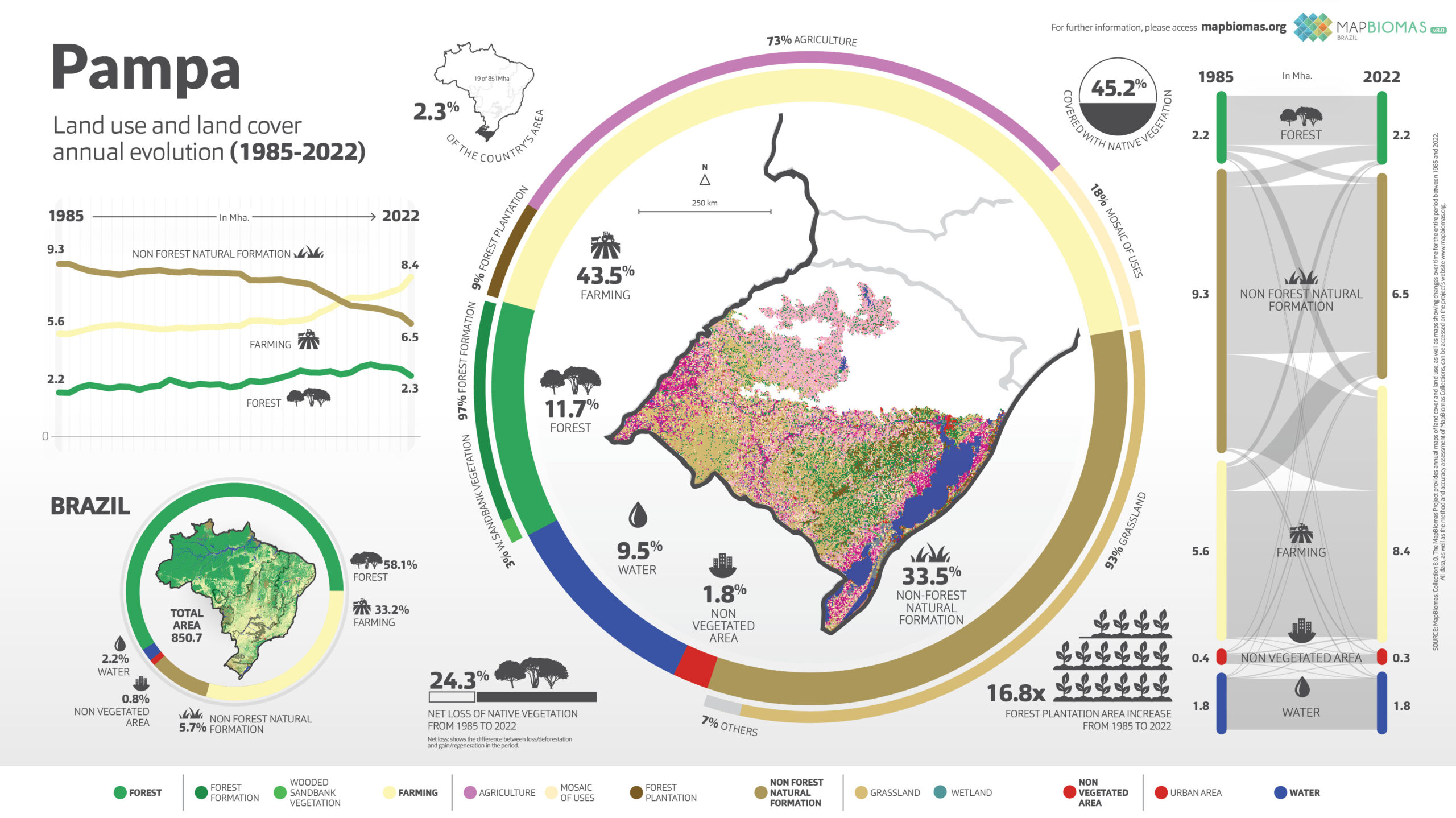
Pampa
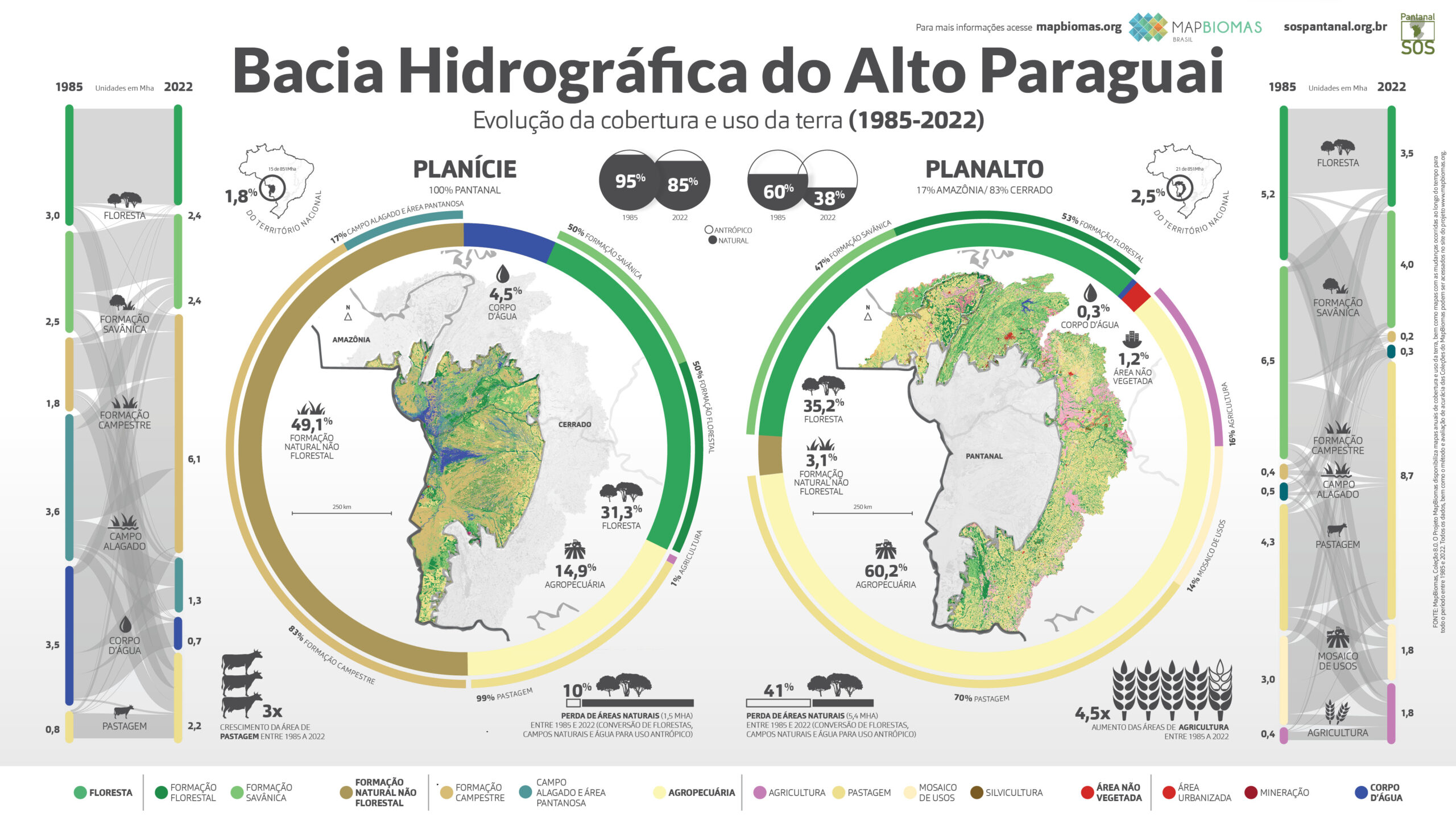
Bacia do Alto Paraguai
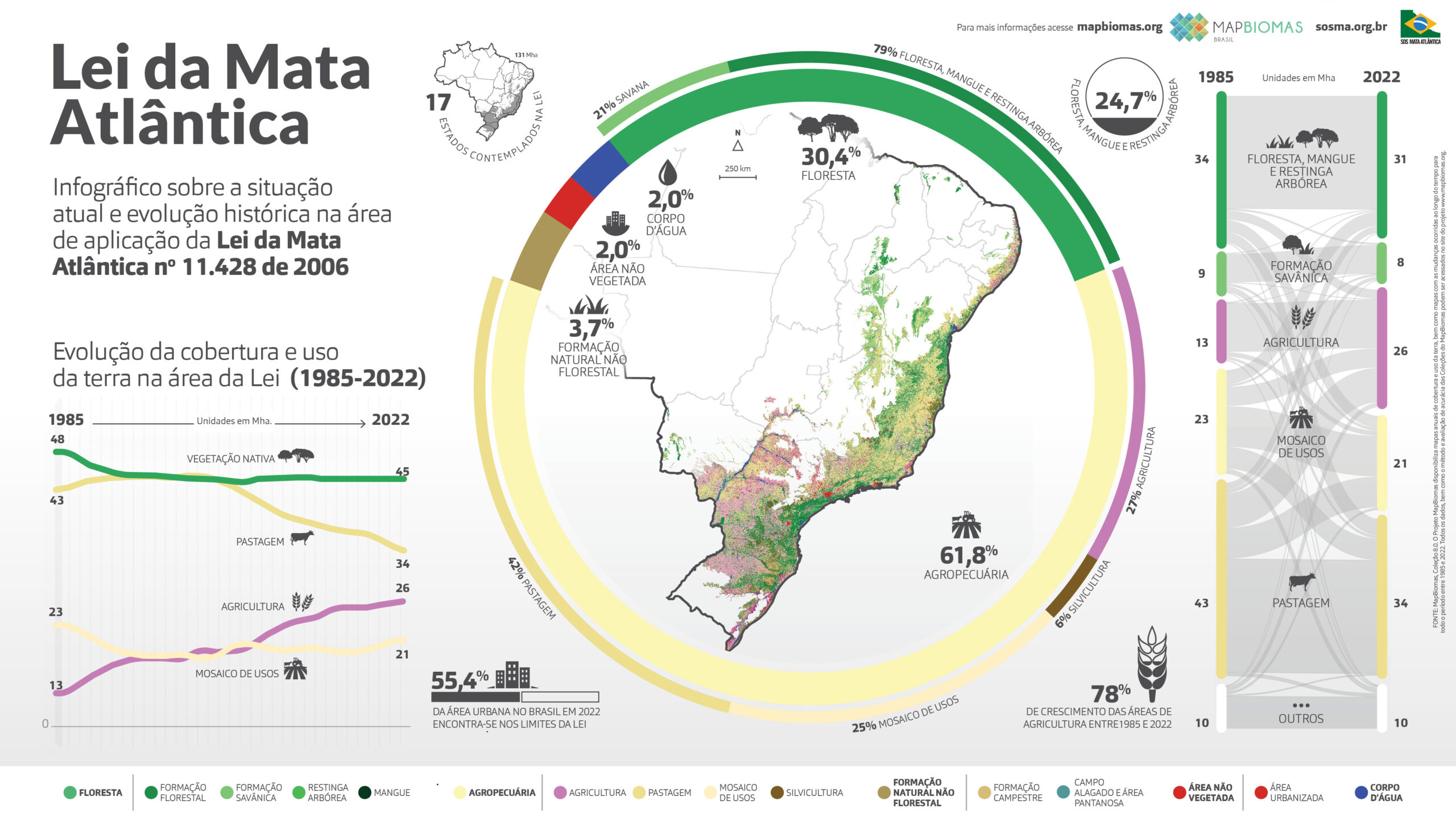
Lei da Mata Atlântica
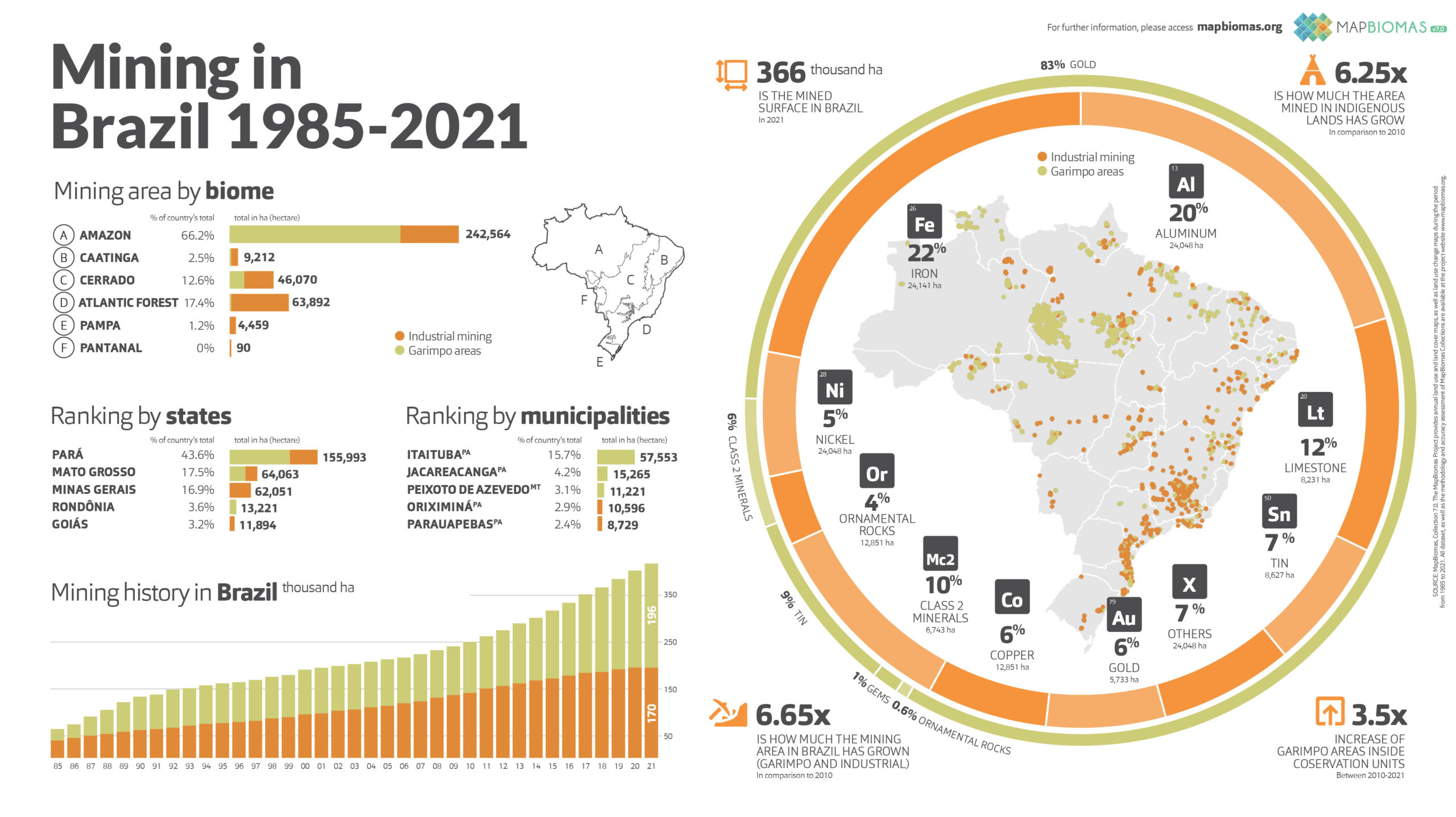
Mining
Fire
Soil
Water